It appears that in the past ten thousand years or so, since the end of the Ice Age, sea levels have risen to inundate the coastline of the Togean Islands, but surrounding water of Tomini Bay are so calm that the inundated landforms remain largely intact.
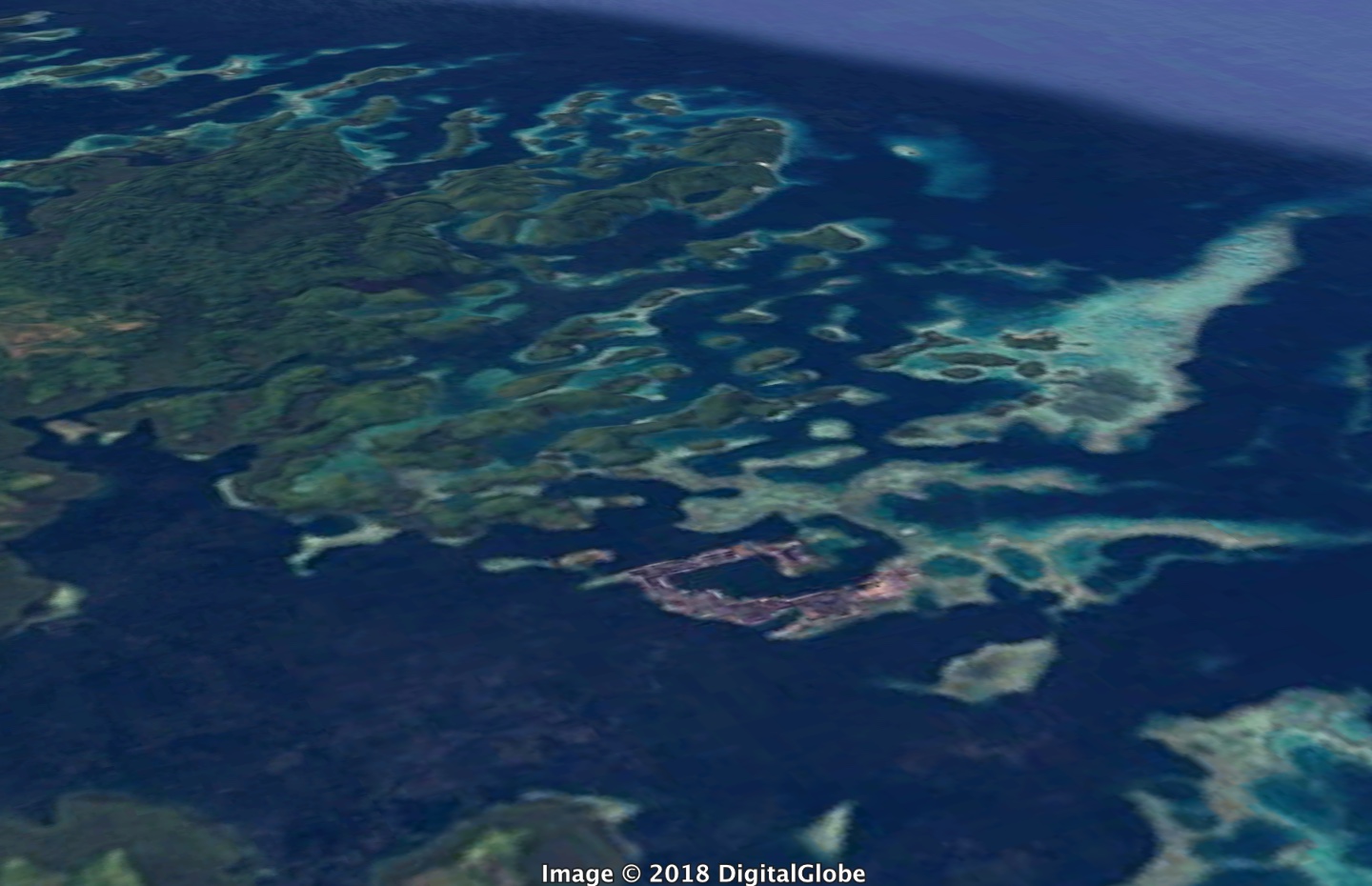
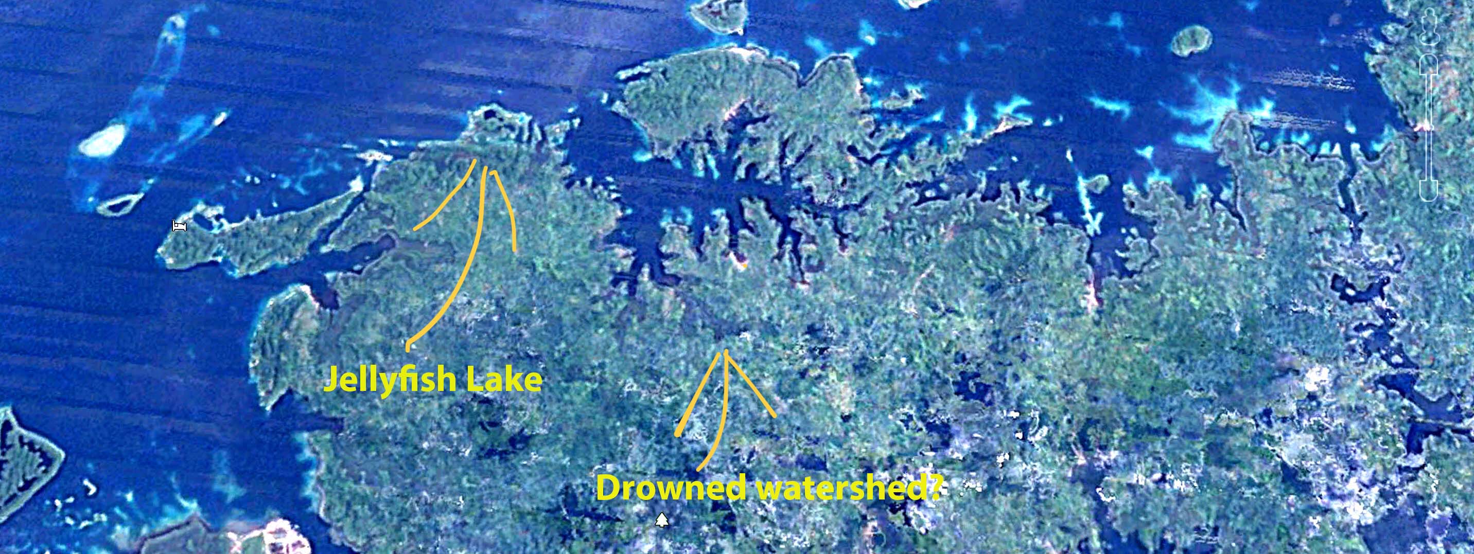
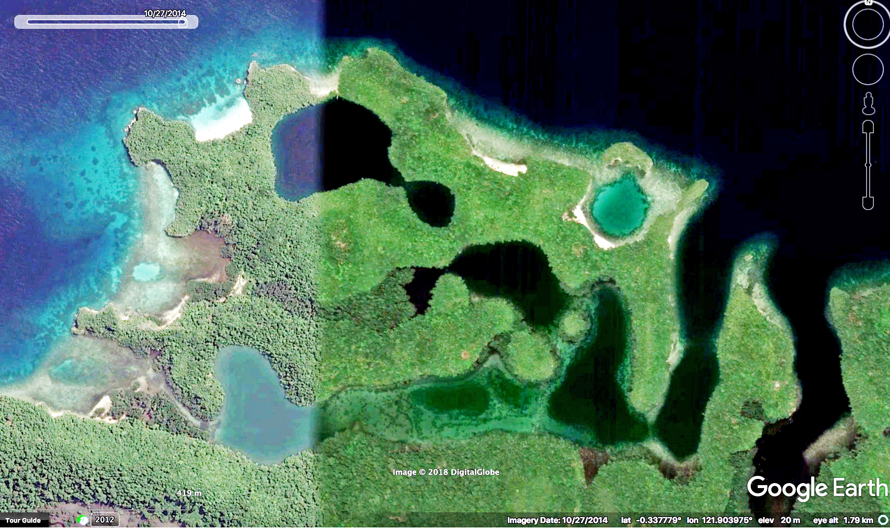
Kabalutan village and the southern margin of Tala Teoh Island rendered from satellite imagery in Google Earth. This half-drowned landscape belongs to the Luwuk Formation, coral-derived limestone that rose above sea level within the past two million years and now appears to be sinking again. It really looks like a coastal watershed that once drained southward (up and right in the photo) when sea levels were lower than they are now.
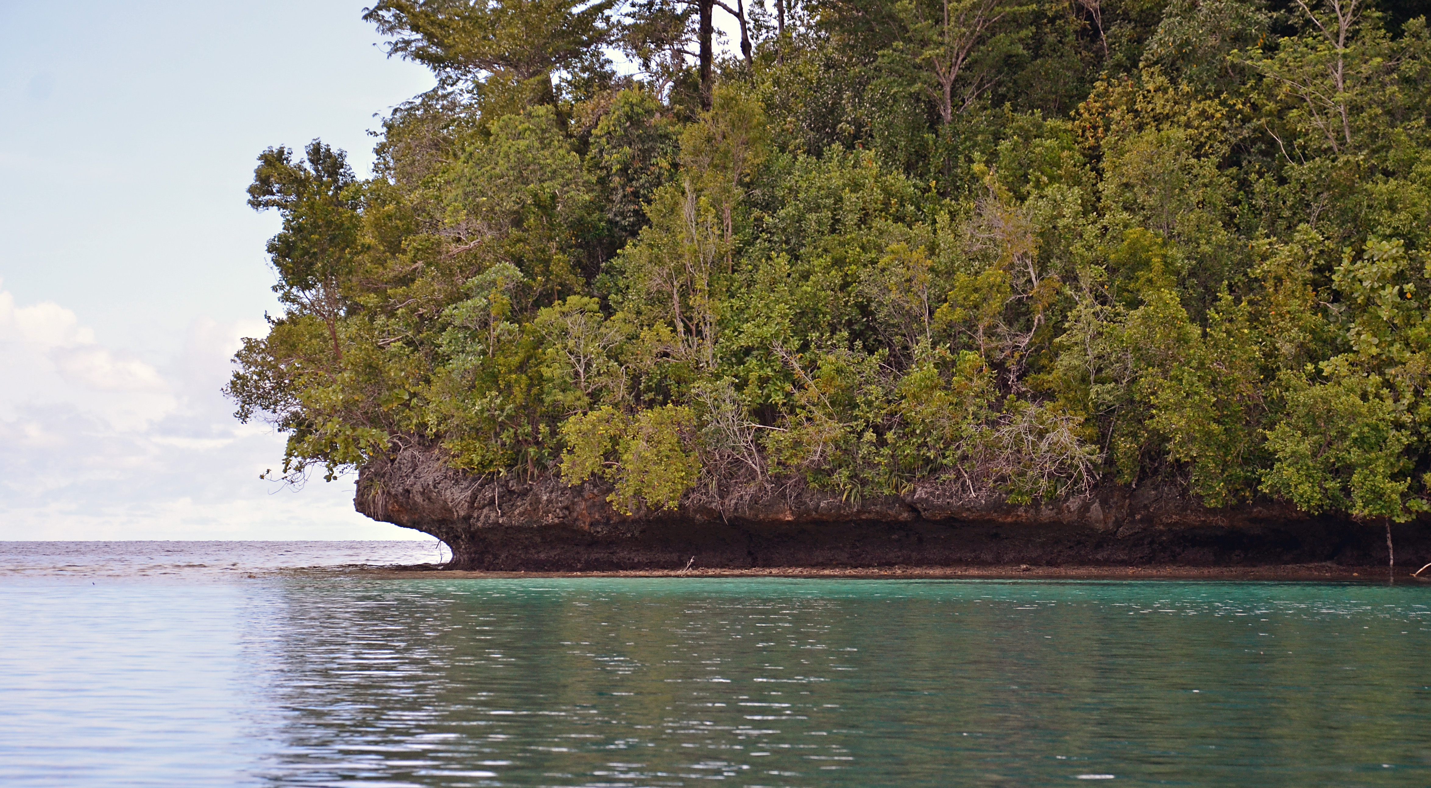
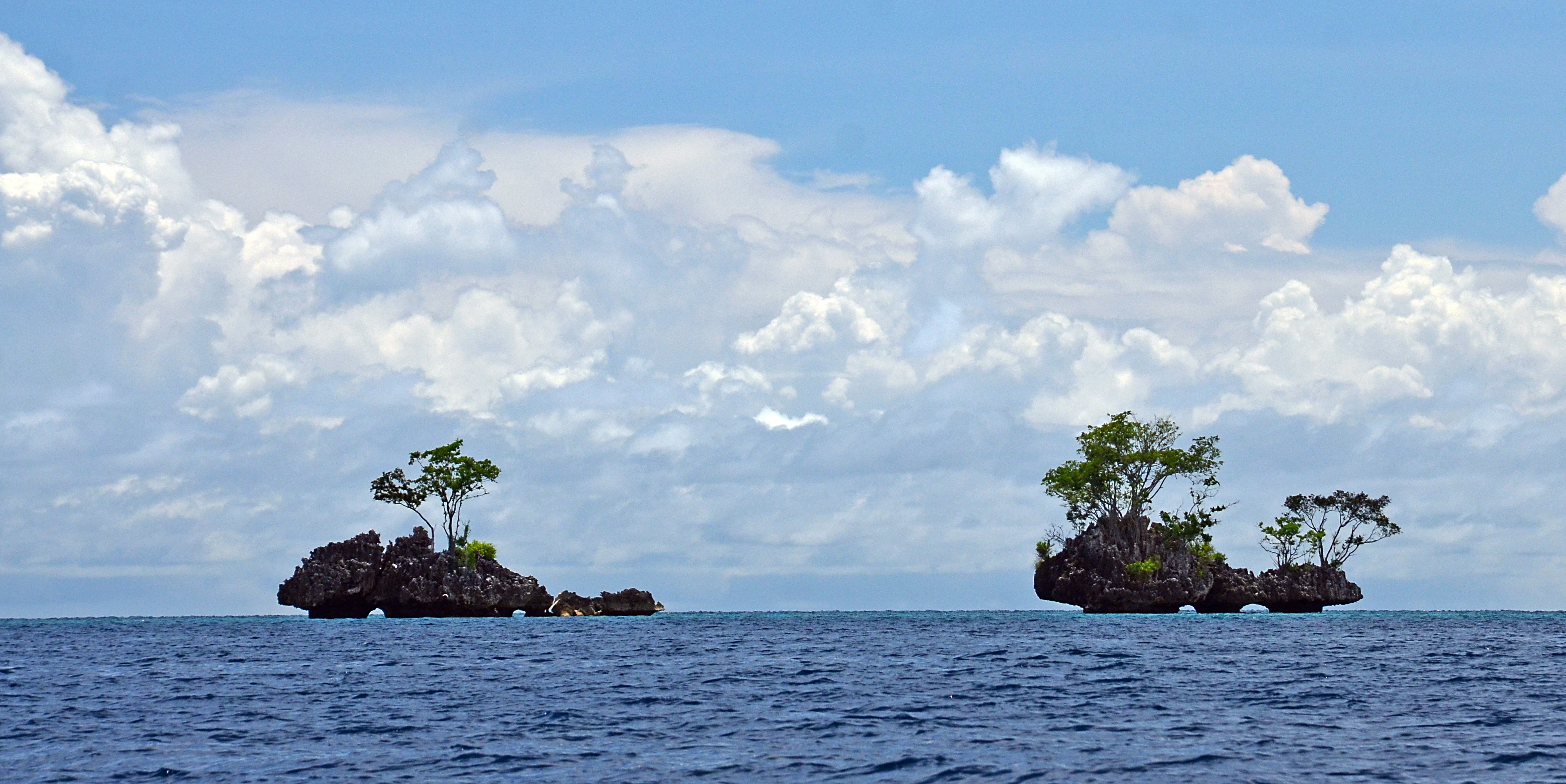
Much of the Togean Island shoreline is limestone, cropping up jaggedly about ten meters or so, sharply in-cut just above the high tide line. Like the limestone towers of southern Thailand, this calcium carbonate is biogenic: its crystal structure shows that it was precipitated from sea water by living organisms. However the creatures whose metabolic energy made the limestone of southern Thailand lived in Paleozoic time, more than 300 million years ago. The limestone of the Togean Islands is Quaternary, less than one per-cent as old.
Quaternary limestone crops up from the northwest shoreline of the Togean Islands. Undercutting looks like mechanical erosion from recent storms, but is more likely to result from millennia of scraping by intertidal animals like chitons that thrive were waters are usually calm. This undercutting might have happened some thousands of years ago when sea levels were higher than they are today.
A story of young limestone, formed from coral and raised a few meters above sea level, is compatible with the active tectonics of Sulawesi and Tomini Bay. This pattern occurs as well in other parts of Indonesia like Flores island, where limestone from Quaternary coral reefs has also hoisted above sea level. But the Togean Island shoreline, which rose above sea level in the past couple of million years, appears to have partially sunken again in the past few thousand.
Does this argue for a more recent, tectonically-driven subsidence? It’s possible that the land has subsided, but Holocene (post Ice Age) sea level rise is a more parsimonious explanation. During the Last Glacial Maximum (less than twenty thousand years ago), sea level was more than a hundred meters lower than it is now. A rise to modern levels would be just about right to explain the flooded drainages, the artificial-reservoir-like bays, and flooded dolines like Jellyfish Lake.
Five atoll-like platforms rise from deeper water a few kilometers off the northern edge of Malenge Island. The westernmost platform, called California Reef, is nearly exposed at low tide, the easternmost, Reef Five, is several meters below the surface. These are not true atolls, which are oceanic structures, but are probably low-lying surfaces that have submerged, eroded smooth and acquired a veneer of coral reef in Holocene times. The sides of California reef, too steep to support coral, may be composed of the Quaternary limestone, though it would be good to check that more carefully.
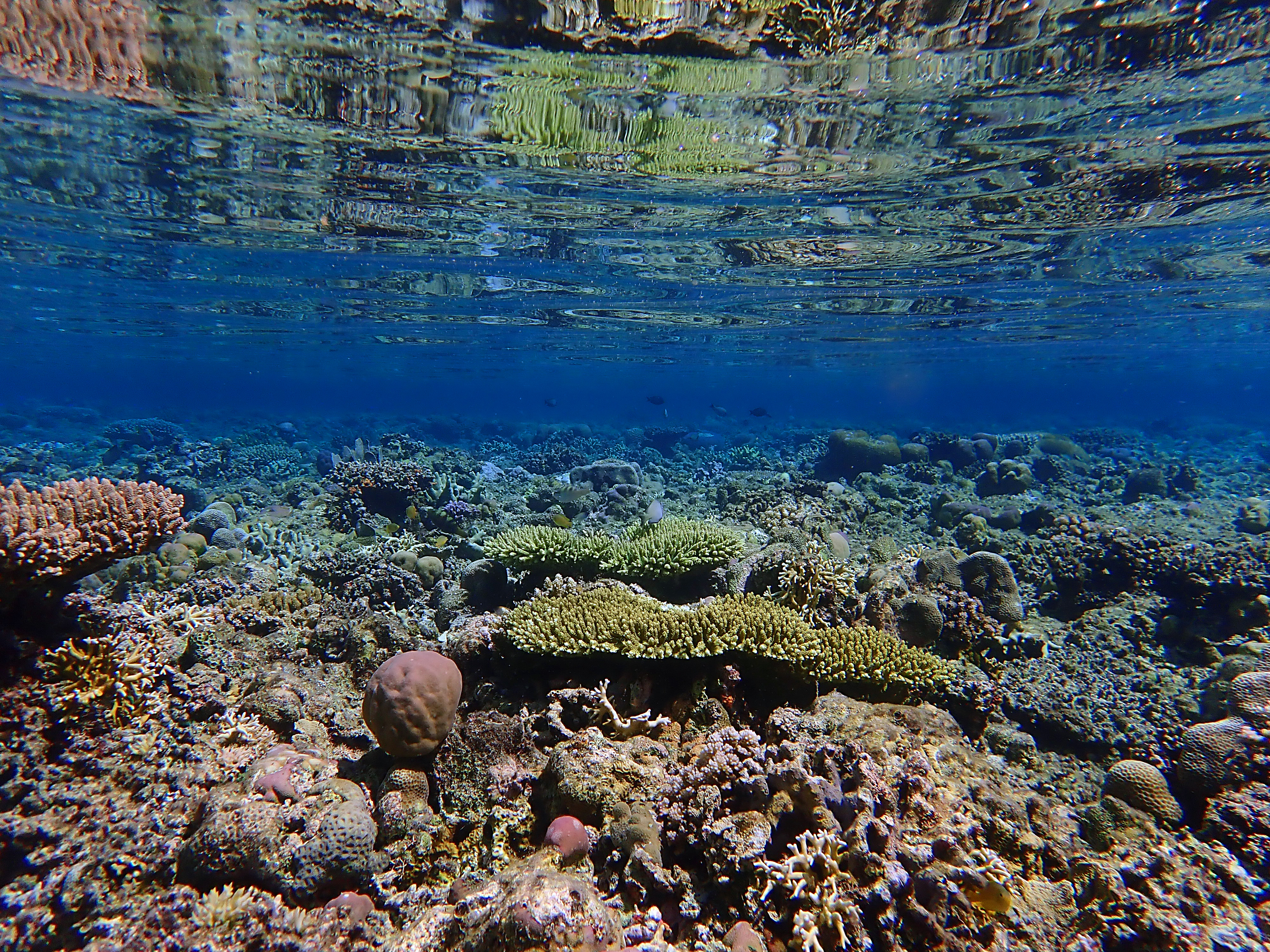
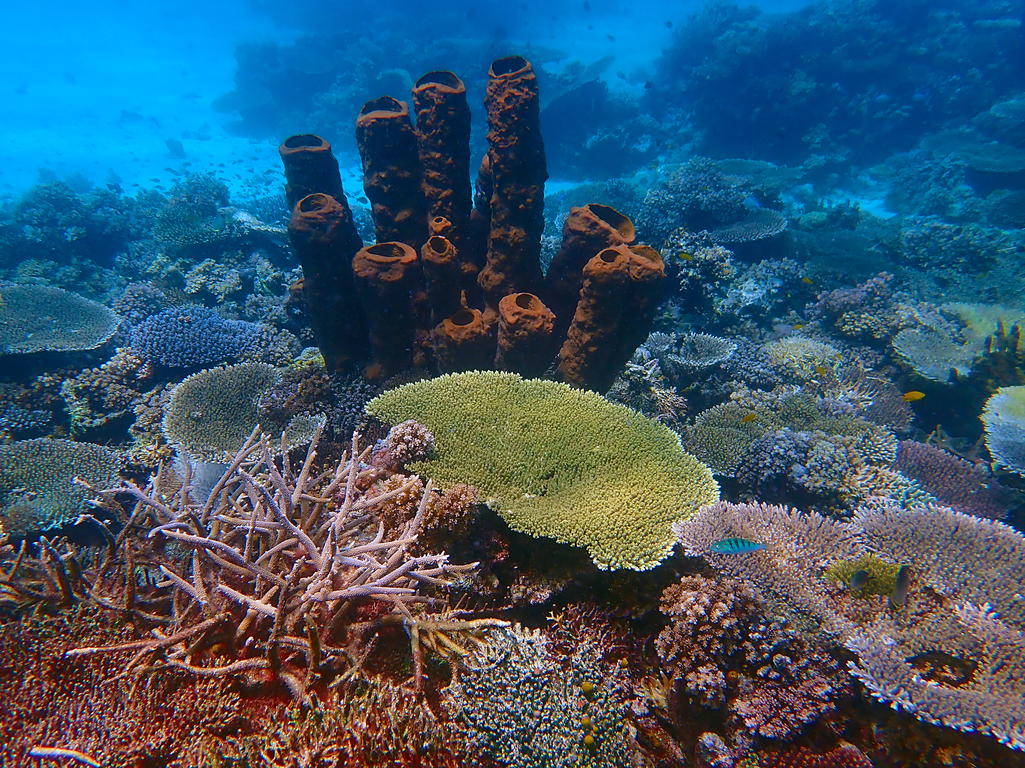
California Reef, reflected by calm surface waters, may be a submerged platform of Quaternary Limestone. It’s surface is less than a meter from the low tide level.Reef Five, another submerged surface a couple of kilometers north of Malenge Island, lies several meters below the surface and supports beautiful colonies of tabletop Acropora branching coral.
As sea levels have risen over the past 12,000 years or so, pre-Holocene landforms have been inundated without having been destroyed by wave action. Tomini Bay, which surrounds the Togean Islands, is especially placid by oceanic standards for a couple of reasons. First, it lies almost exactly on the Equator, so it does not receive typhoons, which are bound to drift poleward as they strengthen. Second, Tomini Bay is sheltered by the northern and eastern peninsular arms of Sulawesi, offering a safe harbor not only from the waves of more distant storms, but from those of the seasonal trade winds that blow down from the East China Sea. Perhaps the sheltering arms of Sulawesi are explain how fragile topographic features like dolines and stream channels have survived intact along the shore of the Togean Islands, while they have been obliterated in other places like Peninsular Thailand. It more exposed locations, Holocene sea level rise would have been accompanied by higher wave energy that would have altered coastal features as they were inundated.
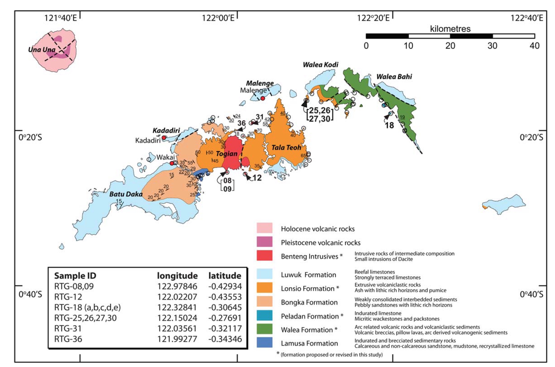
Light blue is the Luwuk Formation of Quaternary limestone, the contours of which have been preserved even as they sink into the sea. From: Hall, R., Cottam, M. A. &Wilson, M. E. J. (eds). 2011. The SE Asian Gateway: History and Tectonics of the Australia–Asia Collision. Geological Society, London, Special Publications, 355, 177–202. DOI: 10.1144/SP355.9 The Geological Society of London.
This article is about a marine lake in the Togean Islands of Indonesia, full of jellyfish that do not sting people. Here I muse about the how the lake formed, about its distinctive ecology, and how it fits into a narrative of ecosystem collapse without necessarily indicating collapse. Wildlands Studies, an academic partner of Western Washington University, enabled our team to visit Sulawesi in February 2018. Betchart Expeditions got me there in 2013 and 2016. To both of these organizations. I feel gratitude.
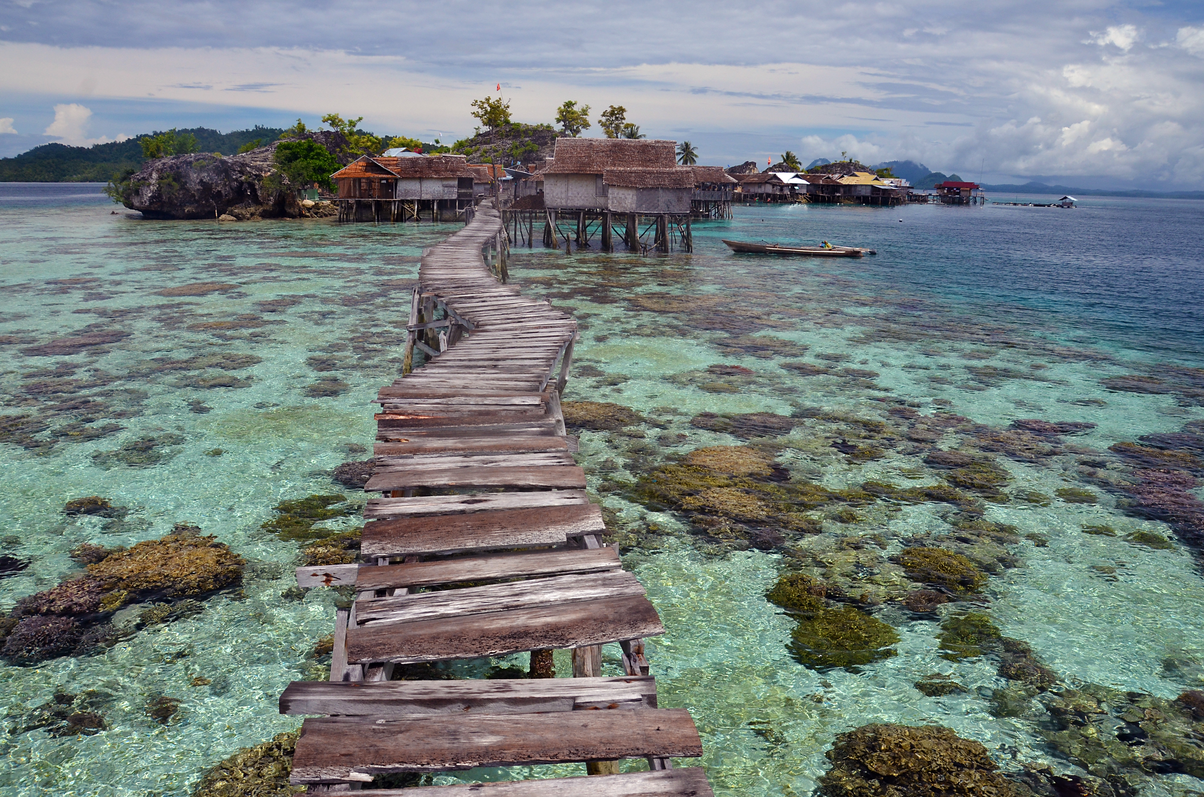
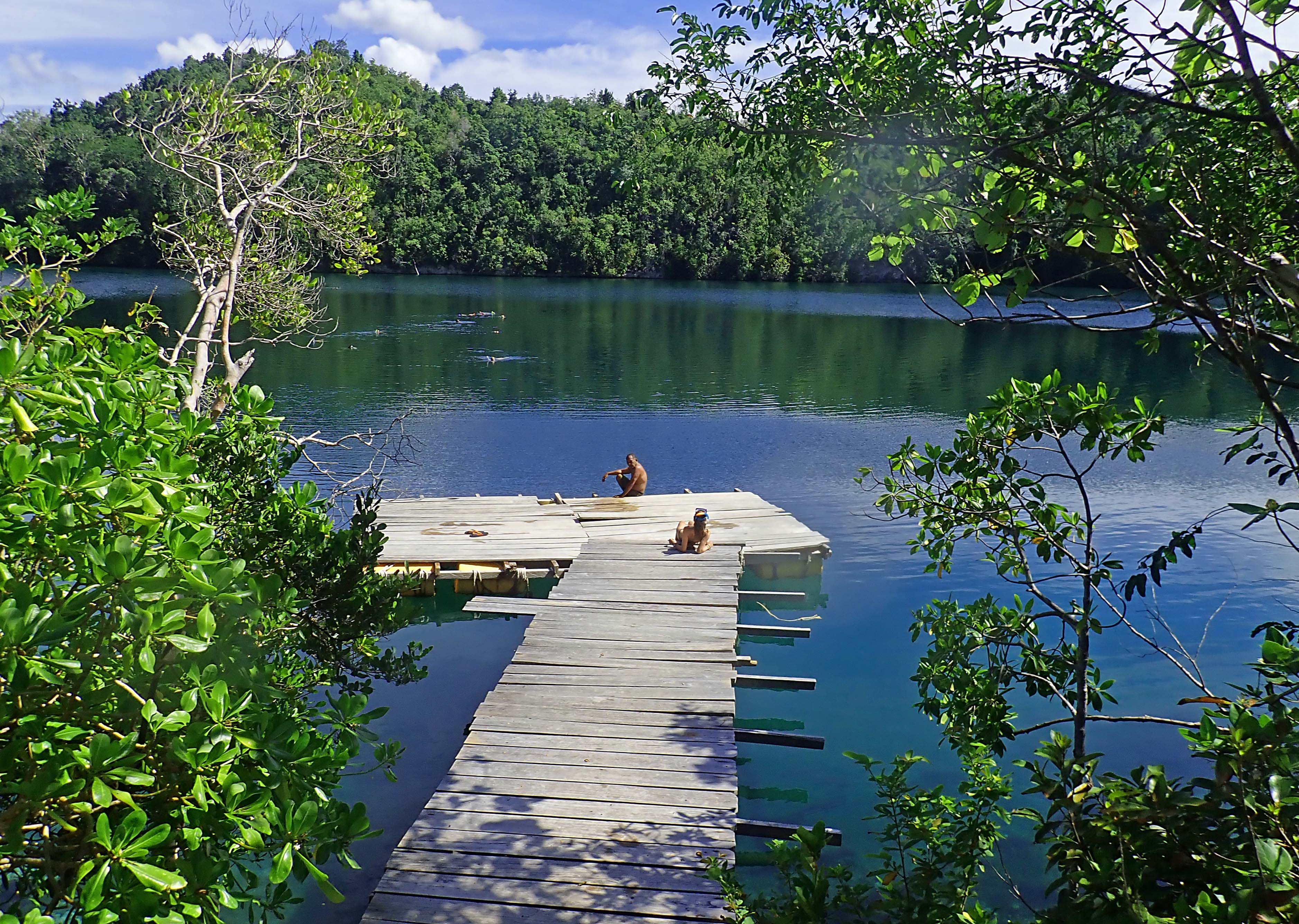
Equatorial magic along the arc of the Togean Islands, Pulau Papan in 2013. The plank walk has since been upgraded.
When the horizon is clear, the view from the Togean Islands includes two distant mountain ranges on opposite sides of Tomini Bay, one range to the north of the Equator, one to the south. Both belong to the Indonesian island of Sulawesi. Tomini Bay is about the size of Lake Superior, so the mountains are not near at hand, but they are very high and the air is clear in this sparsely populated, maritime realm. The waters of Tomini Bay are as deep as the mountains are tall and the bay itself is nearly encircled by Sulawesi’s long peninsular arms.
The Togean Island arc, seen from Tanjung Api on Sulawesi’s Eastern Peninsula, appears to hover above the horizon. Most likely, this mirage is happening because, following rain, the ocean is warmer than the air. My student Rachel observed that the water in Tomini Bay feels like butter.
Like much of the Indonesian Archipelago, the ocean basins around Sulawesi are tectonically active. Una Una, the volcano in Tomini Bay, erupted hard in 1983, and its ragged, truncated profile suggests that it might have blown sky-high in prehistoric times. Such explosive tectonics follow great rumblings of magma deep in the crust of the earth, which can cause the sea floor to rise or subside.
Evidently, in Quaternary times (less than two million years ago) the Togean Islands’ northern margin rose from the sea as a shelf of coral-derived limestone that dissolved slowly in the mildly acidic tropical rainwater. Much later, perhaps only tens of thousands of years ago, the sea reclaimed some of this upthrust coral, either because the formation subsided again, or simply because sea levels have risen over that time. It is not evident from a boat, but in an aerial perspective, the Togean shoreline looks like the flooded watershed of a reservoir, artificially dammed.
Limestone in the northern part of the Togean Islands is derived from corals that thrust above sea level in Pleistocene times. Undercutting visible a couple of meters of the waterline may result from abrasion by chitons and other marine creatures that thrive where the water is calm most of the time. Higher up, it has been dissolved by rain water and organic acids from plants (chemical erosion).Bays along the northern shore of Togean Island display the outline of an artificial reservoir, signaling a flooded watershed. Is it tectonic subsidence, or Holocene sea level rise? Image Google Earth.
The case in point that matters here: a few meters inland, adjacent to a sandy cove called Karina, there is a flooded doline, or sinkhole. This concavity formed by chemical erosion when the limestone was higher than it is now. Since then, the sea has reclaimed the doline to form a marine lake, nearly a square kilometer in size, that appears completely isolated from the ocean, but which must be linked by one or more submarine channels big enough to admit small schools of rabbitfish and other denizens of the coral reefs outside.
The hourglass shaped lake at the top of this image, a sunken doline, must have submarine connections to the sea big enough for rabbitfish to swim through. The lake is much warmer than the ocean. It holds two species of jellyfish and lots of sponges and holothurians you won’t see on the adjacent coral reefs.
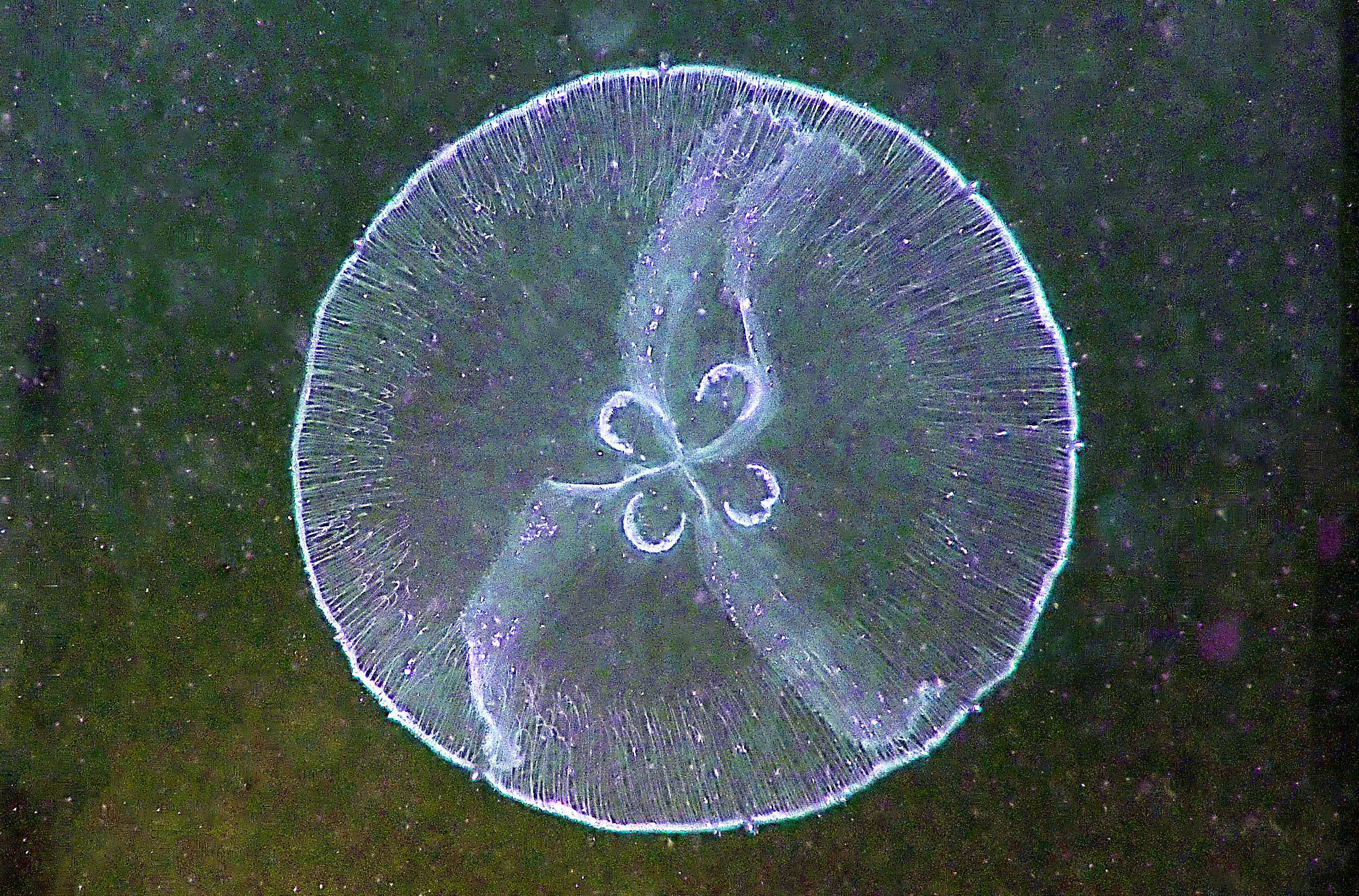
Water temperatures in the lake fall just shy of hot, perhaps in the mid-30° range Celsius. Near the forest-shaded margin, lake waters are clear, but they tinge green with phytoplankton out towards the middle where it is sunnier. The jellyfish appear a few meters offshore and become more abundant further towards the middle of the lake. After swimming a few meters, I see the colorless disk of a moon jelly (genus Aurelia) a couple of meters below. Higher in the water column and much more abundant are white-spotted jellies (Phyllorhiza punctata). Neither species is rare, and it is not the case that this lake has evolved a stingless kind: both species hold venom, but neither can deploy with enough force to penetrate any but the most delicate of human tissues. This makes evolutionary sense: potent, predatory venom-harpoons would be a needless burden for filter feeding plankton-eaters.
Aurelia, the Moon Jelly, is one of two (almost) stingless species of jellyfish in the marine lake on Togean Island.
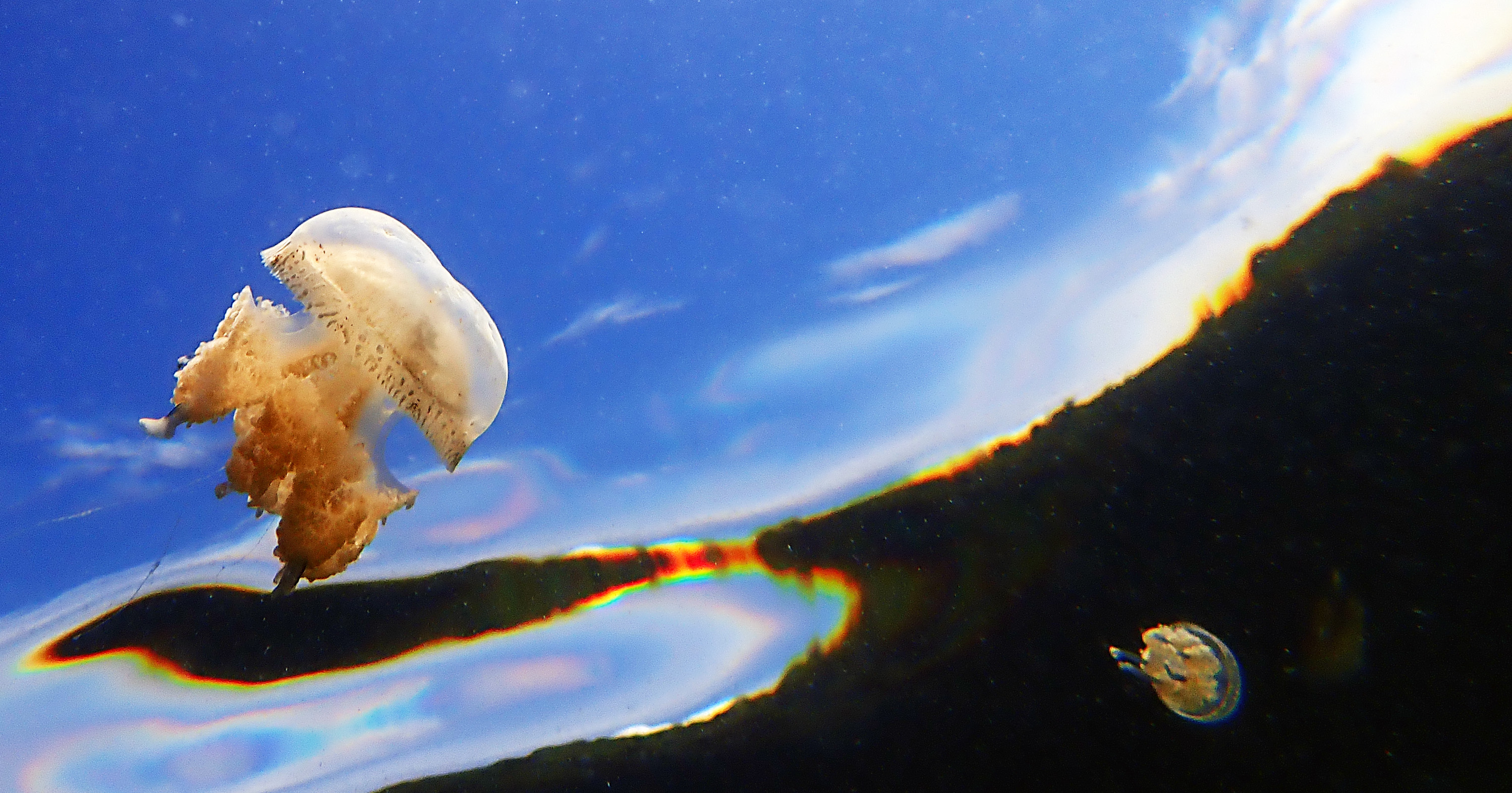
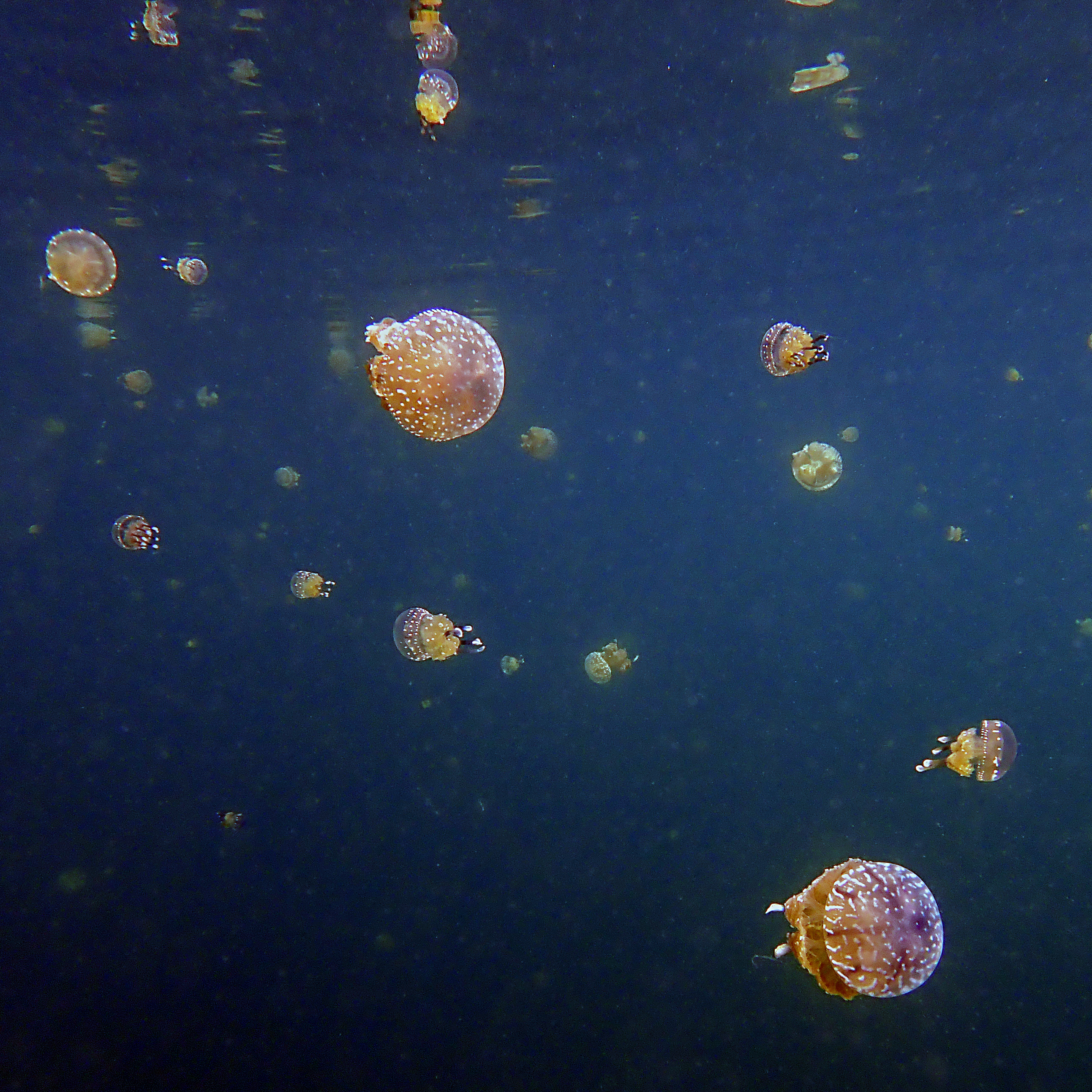
Phyllorhiza punctata, White-Spotted Jelly, is most abundant in Jellyfish Doline.
The jellies pulsate rhythmically all the time, moving themselves along in the aboral (bell-facing) direction, although the particular trajectory does not seem to matter to the animal. Bell size governs tempo. Big ones, the size of a human heart, beat like the heart of an athlete, the little ones flutter adorably. These animals are reputed to move towards sunlight, to aggregate in groups. But today, from our perspective, swimming amongst them un-finned, they seem innocent of any tendency to orient themselves.
Aurelia, the Moon Jelly, is distinguished by four horseshoe-shaped gonads. It is a lethargic plankton-eater that drifts more than it swims and occurs not just in the Tropics, but in oceans worldwide, waters warm and cold. Perhaps because it is inactive, Aurelia can can pulse and feed normally in waters that are oxygen depleted, giving it a big advantage over filter-feeding fishes in places where high nutrient levels enable bacteria to steal the oxygen.
Phyllorhiza punctata, the White-spotted Jelly, is another filter feeder, but it is primarily herbivorous. Since its phytoplankton staple is less energy rich, it filters feeds capaciously. One individual is said to be able to process about five cubic meters of water a day.
Jellies have an uncommon degree of tolerance for the high temperatures and low pH values that anthropogenic carbon dioxide emissions are inflicting on our oceans. So they are sometimes portrayed as fitting heirs to an ecology of trophic collapse, where the absence of predators unravels and simplifies the food web.
The business end of Phyllorhiza punctata.
To me, this floating in a boundless bath of jellyfishes, each pulsating to its own tempo, is hallucinatory, some psychedelic archetype. Maybe that’s a cultural legacy of my own upbringing. But my students, upstanding Twenty-First Century United Statesians, with a cultural orientation way different than mine… they dig it too.
White-spotted jellies, filter feeding around my students who have removed their fins out of compassion for the invertebrates.Resonates with memes about the oceans of Enceladus
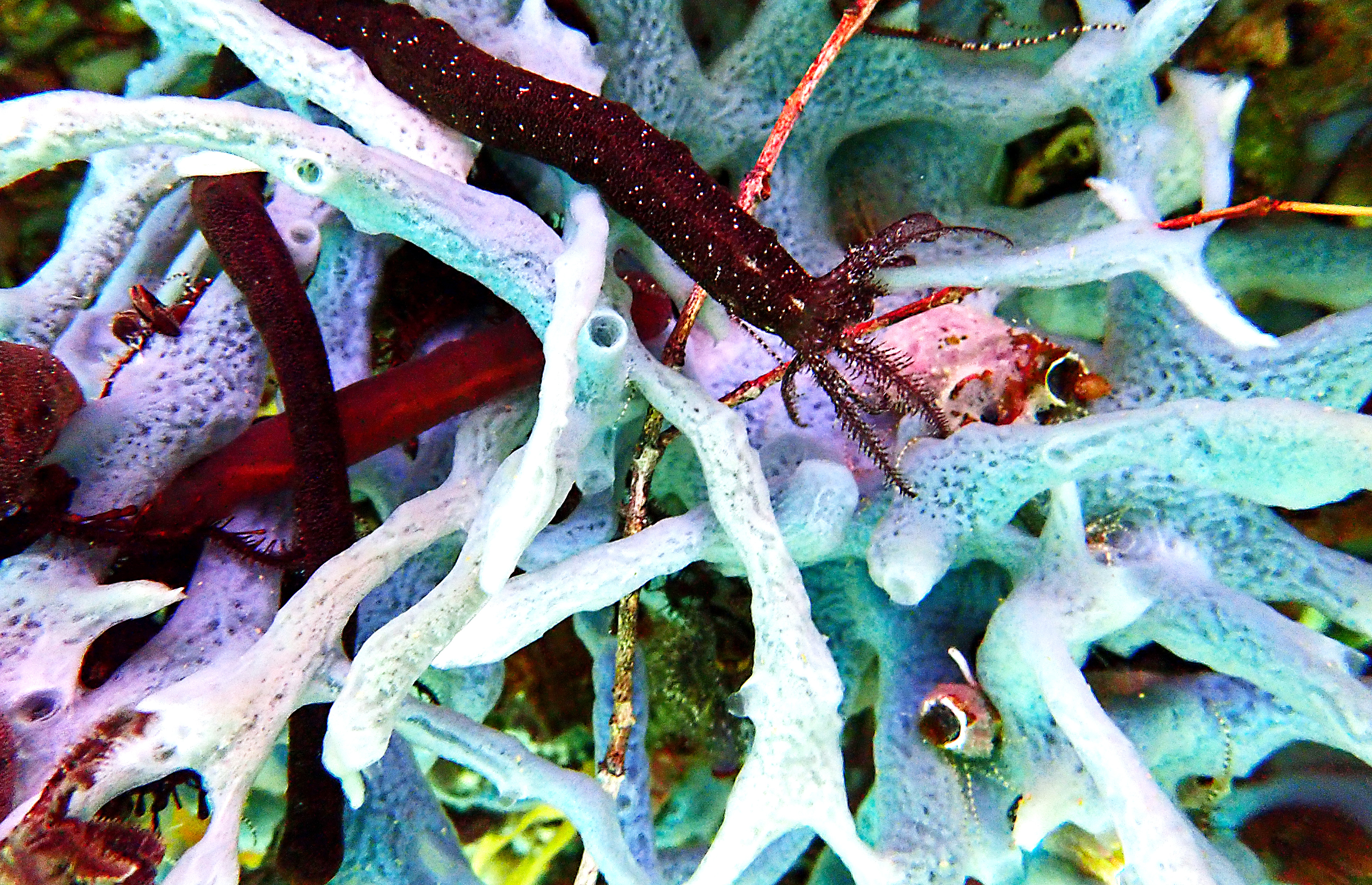
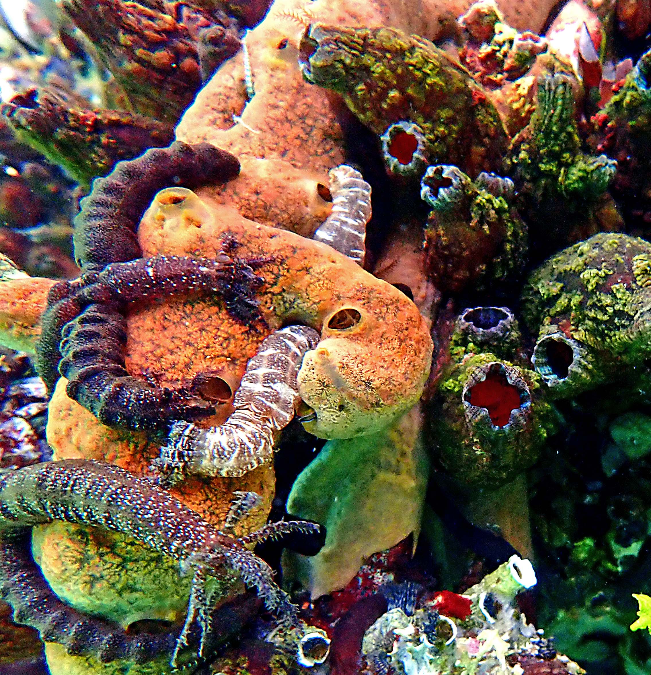
After a time, I make my way over to the edge of the doline, where mangroves and forest trees hang over the water and trail their roots into it. Below waterline, the calcareous walls hold a fauna different from anything I’ve seen before. The taxa are familiar enough — sponges, holothurians, tunicates, mussels — but the forms and the abundances are unlike any other place I’ve been. Mussels and a tangle of cordlike, orange and pale-blue sponges are the substrate, which is twined through by a profusion of the sponge-loving synaptid sea cucumbers. Out on the reef, we see lots of noodle-sized synaptids, hunkered against barrel sponges. But these lake dwellers are thick as weenies and wend themselves gelatinously amongst and through the siphons of the sponges, nourishing themselves perhaps on such sugars as sponges are said to produce in excess. If the lake is a psychedelic archetype, this lurid milieu of dark bivalves and worms penetrating the orifices of sponges is a horror archetype, and I’m enthralled.
Stranger Things: Sponges in this warm marine lake are different from those on the adjacent coral reef, and green macro-algae flourish. Mussels, infrequent on the reef, achieve a high density on the limestone walls of the doline.Synaptid sea cucumbers have a thing for sponges, but the sponges and the synaptids of Jellyfish Doline are different from those outside on the coral reefs. This synaptid has its feeding tentacles extended as most do, most of the time.Sponges, and tunicates seem to compete for space on the shaded walls of Jellyfish Lake. Synaptids ignore the tunicates and appear to seek maximum intimacy with the sponges, entering one siphon and emerging from another.
Coral is conspicuously absent in the warm waters of Jellyfish Doline. This conforms well to our understanding that corals can’t take heat, and are vulnerable to global warming, but it could also be that the waters here do not circulate enough and do not contain enough zooplankton prey to sustain a coral. To the teacher in me, this hypnotically beautiful flooded doline is the ideal proxy for a version of ecosystem forcing and trophic collapse currently in fashion at the dawn of the Anthropocene. Corals, the constructive architects, are gone. In their place, amorphous, pliable sponges coat the walls, flaccid holothurians scouring them inside and out. Together with the jellies, we swim in a warm bath of phytoplankton upon which only the jellies feed. The lack of tiny plankton predators evokes the specter of trophic collapse. The jellies don’t threaten us as we swim amongst them; they need no defense in this realm. In the same spirit, we see on the walls of the doline luxuriant growths of macro-algae; the algae-eating sea urchins and parrotfish are absent.
Fish are nowhere abundant in Jellyfish Doline, and seem to prefer the clearer margins of the lake. Most apparent are gobies, Strongylura needlefish (pictured here, reflected on the surface) and herbivorous rabbitfishes.
Jellyfish Doline appears to be a limestone sinkhole that subsided and filled with water from the ocean nearby. The lake is full of jellyfish that filter feed on microscopic algae and seem to lack predators.The collapse narrative is convenient, but maybe here it’s just a metaphor. Can I conclude it like this? The ecosystem of Jellyfish Doline would be a sad substitute for the wild profusion* of species on the coral reefs outside, but as an exception to the norm, it’s entrancing.