On Wednesday, December 7 Nature published a report about how rivers and lakes change their size and location on Earth’s surface. The people at Springer were good enough to make the Nature report accessible to the public, so I can view it and link to it. The report is based on 32 years (and 1.8 petabytes) of Landsat satellite data (NASA and US Geological Survey), compiled by this beautiful thing called the Google Earth Engine that now has a time lapse feature.
On Friday, December 9, New York Times published an interactive feature article Mapping Three Decades of Global Water Change that shows beautiful, detailed animations of some of the patterns discussed in the Nature article.
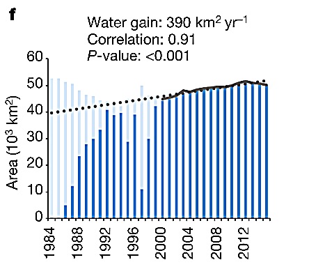
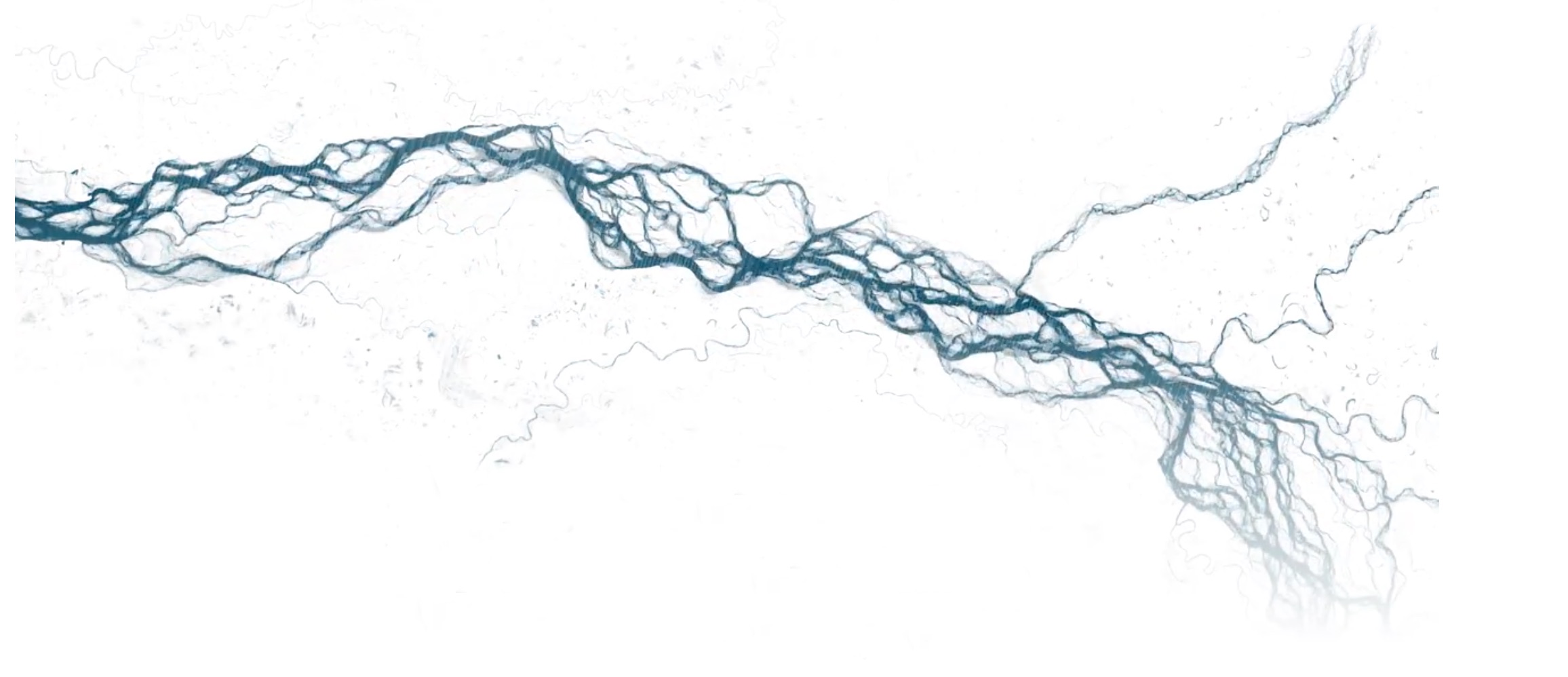
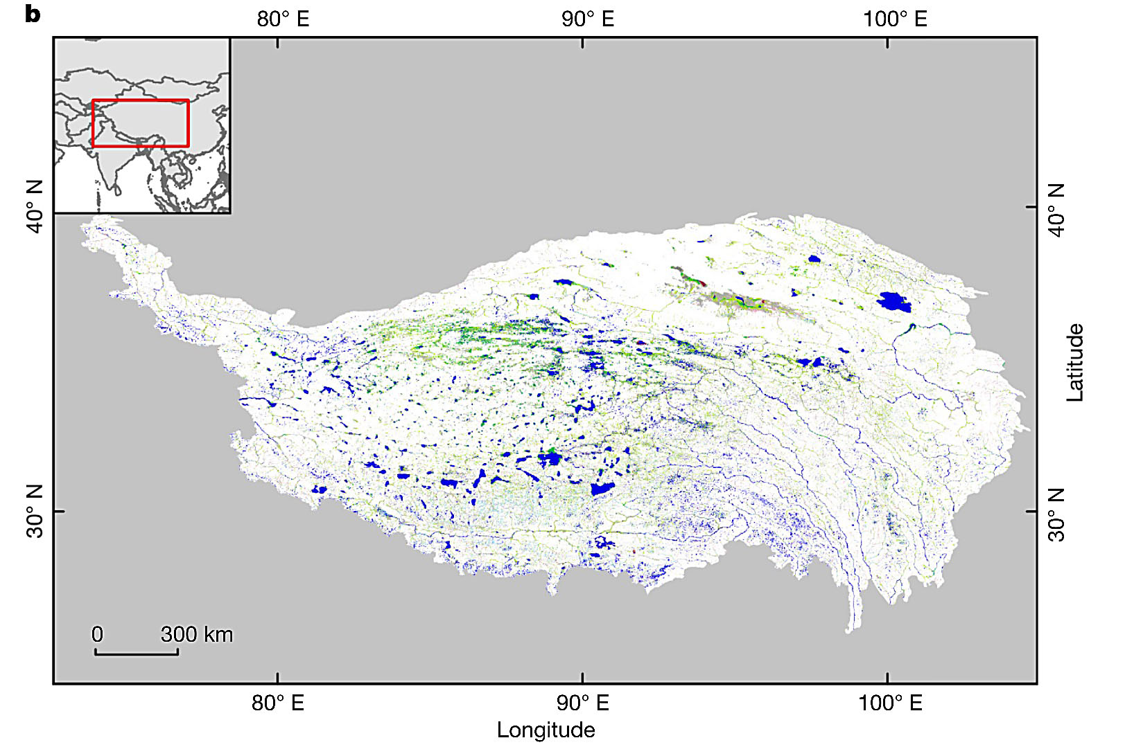
We get some nice examples from the pan-Himalaya: the Brahmaputra River oscillates across the plains of eastern India, distributes itself through the Sundarban Delta, and adds a generation’s worth of new land to the front end of the mangrove. There is an image from Amdo in northern Tibet that dramatizes Nature’s finding that Tibet has increased its surface water, unlike many places on Earth’s surface. I have to question NYT’s suggestion that melting glaciers are the cause, since this enclosed watershed and others nearby appear no more glaciated in 1984 than they are today.
For now, the exciting thing is that Google’s Earth Engine has given us a time lapse feature that smooths, removes cloud cover(!) and animates decades (and petabytes) of choppy Landsat imagery. Now anyone with decent Internet can scroll around Earth’s surface and zoom in for a three decade flip-book cartoon of the places they care about.
We live in interesting times! More to follow.
- *Jean-François Pekel, Andrew Cottam, Noel Gorelick, Alan S. Belward. 2016. High-resolution mapping of global surface water and its long-term changes. Nature. doi:10.1038/nature20584.