On April 20, 2017, a small glacial lake burst its moraine dam and discharged into the Barun river valley, a tributary of the Arun River in Sankhuwasabha District, Eastern Nepal. Rocky debris from the moraine accompanied the glacial lake outburst flood (GLOF), and tree trunks were swept before the descending mass. By Himalayan standards, this event seems to have been relatively modest, but it impacted an area of recognized beauty, biological diversity and cultural significance. This report informally summarizes the observations of a Wildlands Studies team led by Chris Carpenter, Zach Crow and Jamyang Lama and accredited through Western Washington State University in the United States of America. Our team included 15 undergraduate students. We visited the GLOF site 16-24 days after the event.
The Barun valley provides mountaineering access to Makalu, an 8481 meter peak on the border of Nepal and China, and it has become increasingly popular as a trekking destination. Many landscape features within the valley are deeply sacred to local people including those of Sherpa, Tibetan and Rai ethnicity, who regard the Barun as one of the sacred valleys of the Kembalung Beyul (Reinhard, 1978). An uncommonly wet climate and steep topography reduce human impact: some of the Himalaya’s most intact middle-elevation forests are found in the catchment of the Barun river.
The outburst flood occurred just as our Wildlands Studies team was aloft on Yeti Airlines, en route from Kathmandu to Tumlingtar, our starting point for a month-long course of field studies in Makalu-Barun National Park and Buffer Zone. We had planned ten days in Tamkhu and Mangtewa, agricultural landscapes below 1500 meters elevation, and twenty days on the trekking route to Barun valley and Makalu Basecamp. Wildlands Studies visited this region several times in the 1990s, but I had not been back in nearly two decades. I was excited and a little apprehensive to see what changes might have been wrought by years of civil war, political engagement and infrastructure development in the area, and curious as well, I confess, as to how my own body would handle the challenging terrain, a generation down the line.
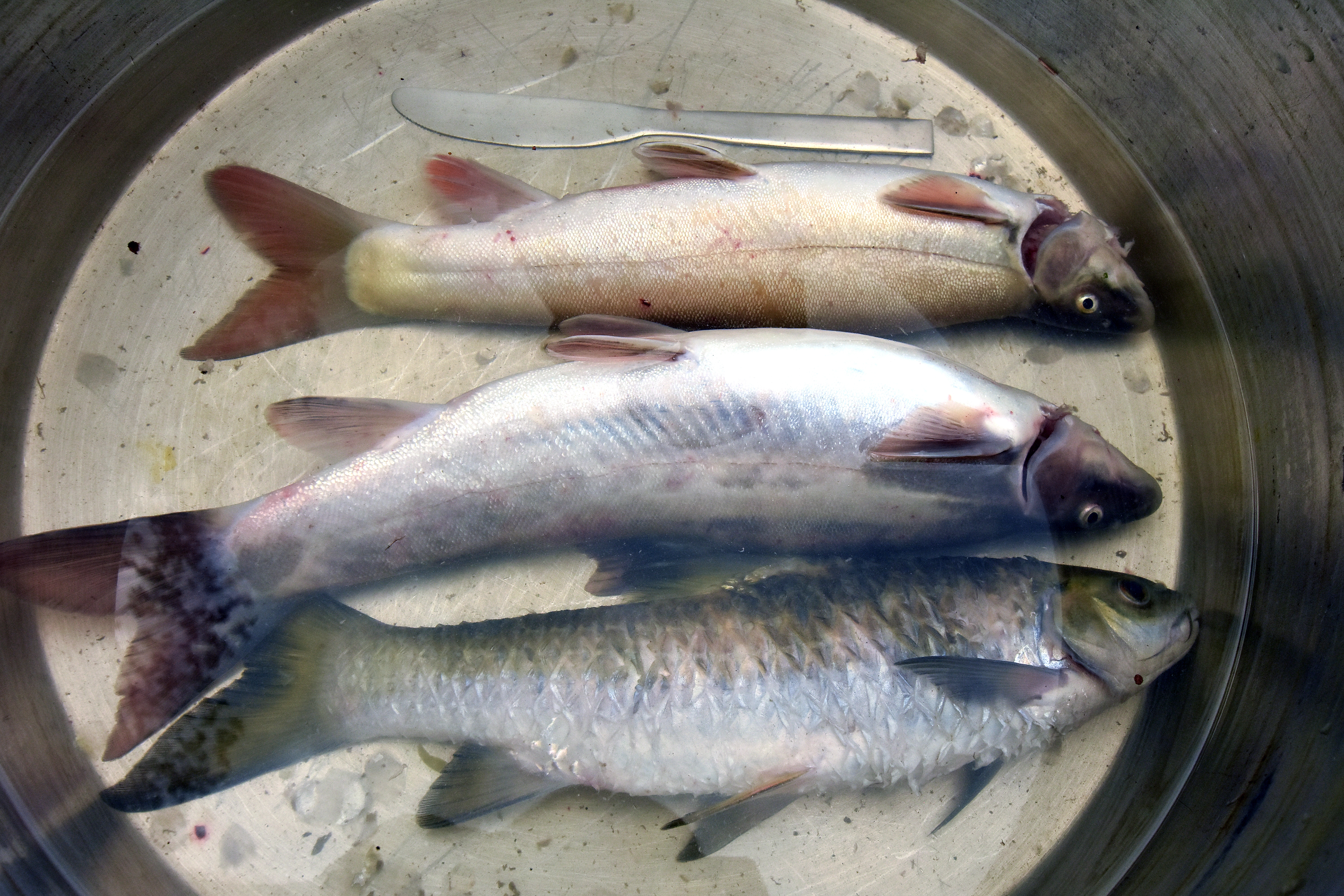
Our first inkling of an upriver disturbance was fresh fish on the morning of April 21. We had camped our first night on a river terrace where clear-water of the Sankuwa river disappeared into the turbid flow of the Arun. Late the previous night, we were told by villagers, the Arun river had risen abruptly, throwing fish onto the grassy bank. Local media were reporting that at 4 pm a landslide had dammed the Arun up near the village of Bhotkhola, near Hatiya (many kilometers upriver of our campsite), and that the army had been dispatched to secure the situation. After a few hours, we were told, the pooling waters of the Arun breached the debris fan, then moved forward, producing a downstream surge. Only several days later did we come to understand that the package of boulders that blocked the Arun river had come down the tributary we were intending to visit.

For several days, we weren’t sure whether we’d be able to hike into the upper Barun at all. We’d heard some yaks and chauri (yak-cattle hybrids) had perished in the outburst flood, and that mountaineers or trekkers had been stranded for awhile, and I knew from past experience that the path along the Barun is landslide-vulnerable under the best of circumstances. It was only after we came up out of the hot jungle and entered Seduwa, along the main trekking route to Makalu Basecamp, that we learned the Barun valley trail was indeed passable, mucky in places but passable.
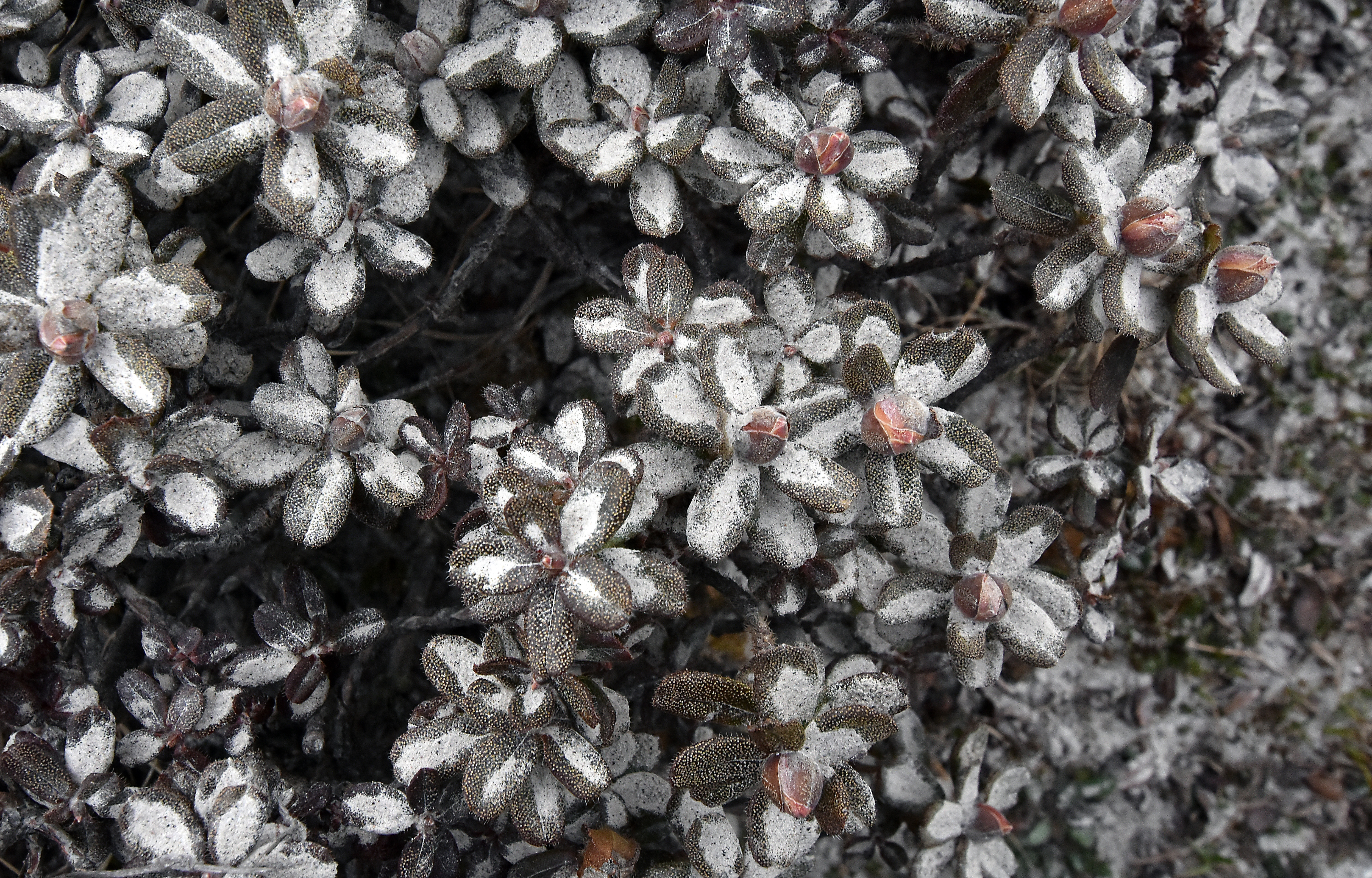
The crossing from Seduwa to the Barun valley entailed several days of climbing into cold rain and fog, followed by a steep descent. On Kongma Ridge we found what seemed to me an inordinate amount of snow for early May. Flowering rhododendron and viburnum offered more than adequate compensation though, and one of my students was lucky to see a red panda on the path just below the Kongma campsite.

We’d heard that lodges — the blue, galvanized steel kind now ubiquitous in the Himalayan hinterlands — had proliferated along this route to such a degree that it’s no longer necessary to camp. The American in me was conflicted about the ‘loss of wilderness’ that this implied, but in fact all of us were deeply grateful for the shelter provided by the enterprising souls of Tashigaon and Navagaon. In climatic terms, Kongma ridge spring 2017 was not a forgiving place and I fear we would have been unhappy campers had we relied on tents for the clients and caves for the porters as was the norm during our excursions in the 1990s.
Reaching Barun valley, we found that the glacial lake outburst flood had reconfigured the terrain to a certain extent, but the valley had not been devastated as we had feared.
In a nutshell:
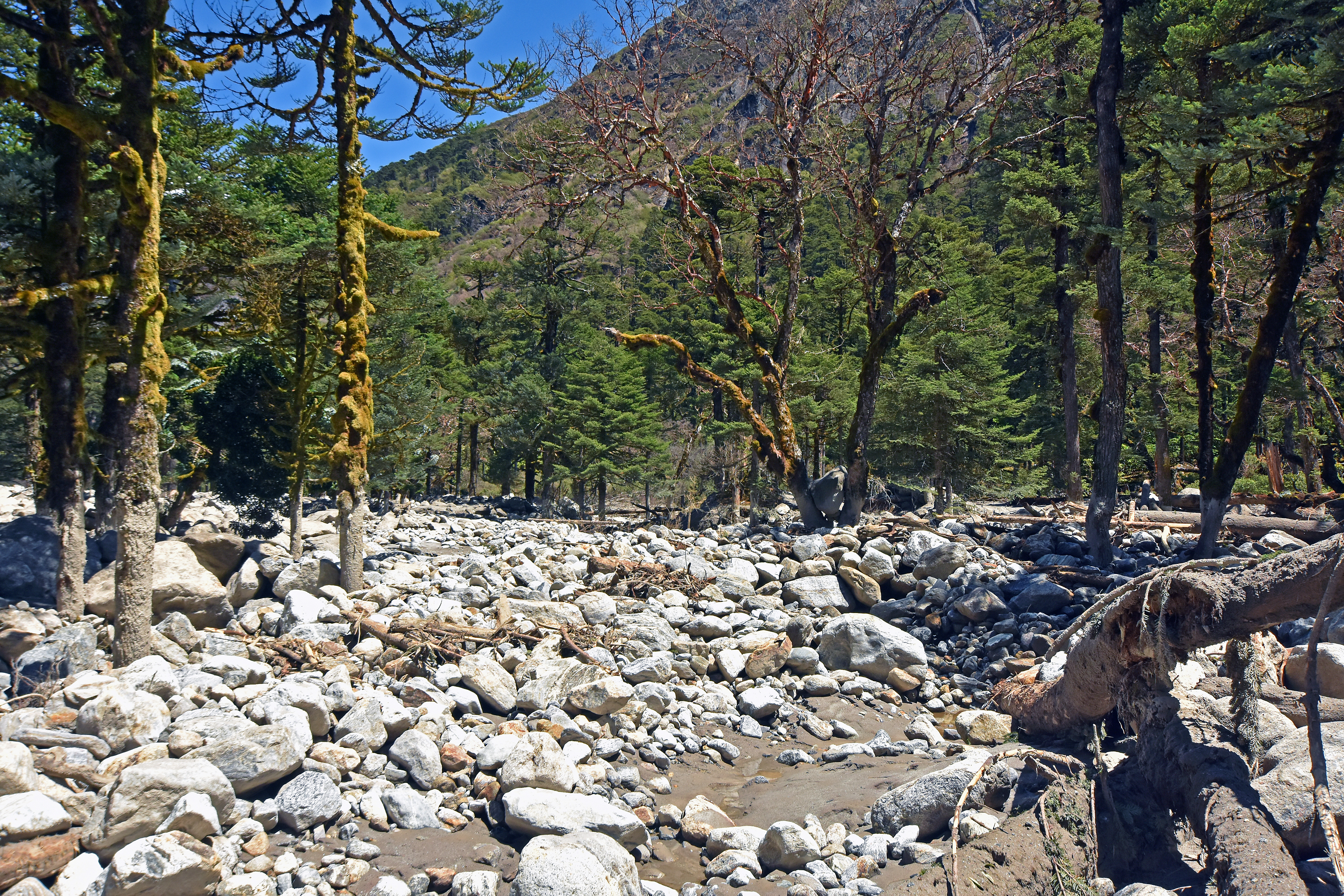
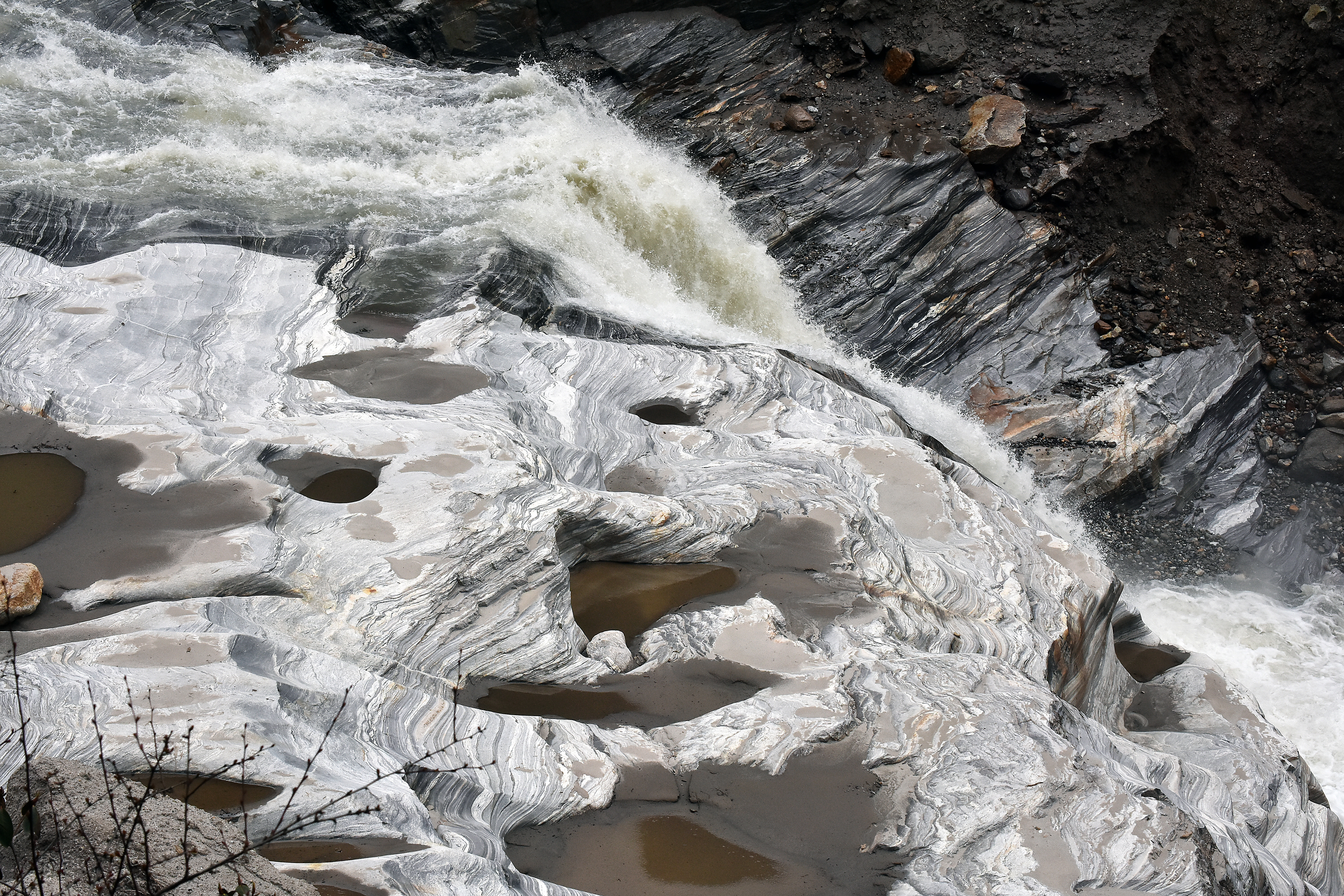
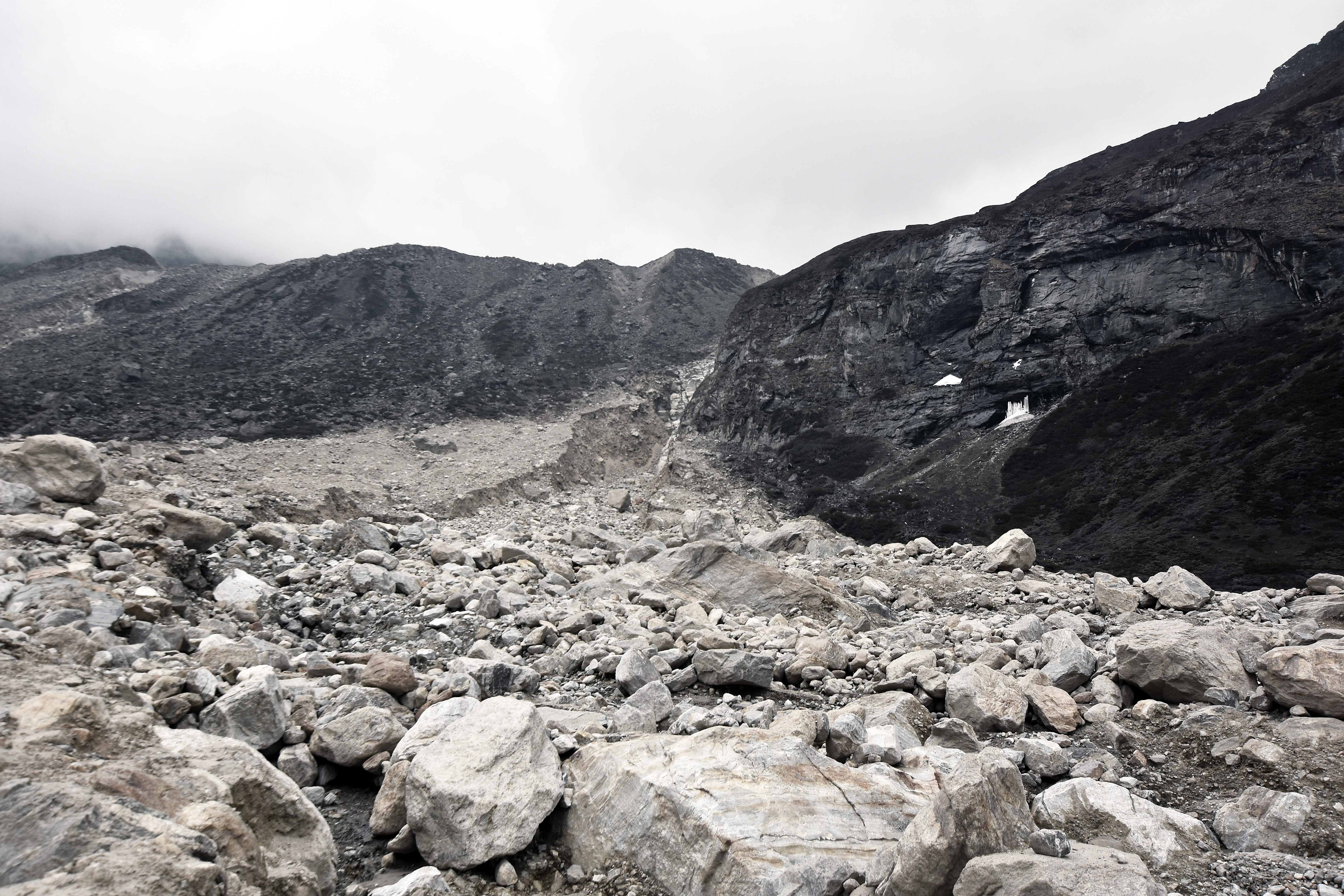
1. The V-shaped section of the Barun Valley, below the pasture of Tematang (Pema Kharka), had been scoured and largely unburdened of its riverine bed load, which had previously filled the channel. We found expanses of naked bedrock exposed at stream level with intermittent stretches of fresh, compacted mud terraced on either side. The boulders and gravel comprising the bed load must have moved further downstream, or perhaps this material went all the way to the Arun river. This outcome contrasts to the ‘bottleneck’ scenario in which these reaches of the valley would trap debris with the potential to impound water in flatter upstream locations like Tematang and Yangle Karka (Byers et al., 2014). Mostly, the main footpath through scree and landslide debris was unaffected except in a few places where we had to detour upslope of avoid collapsed sections.

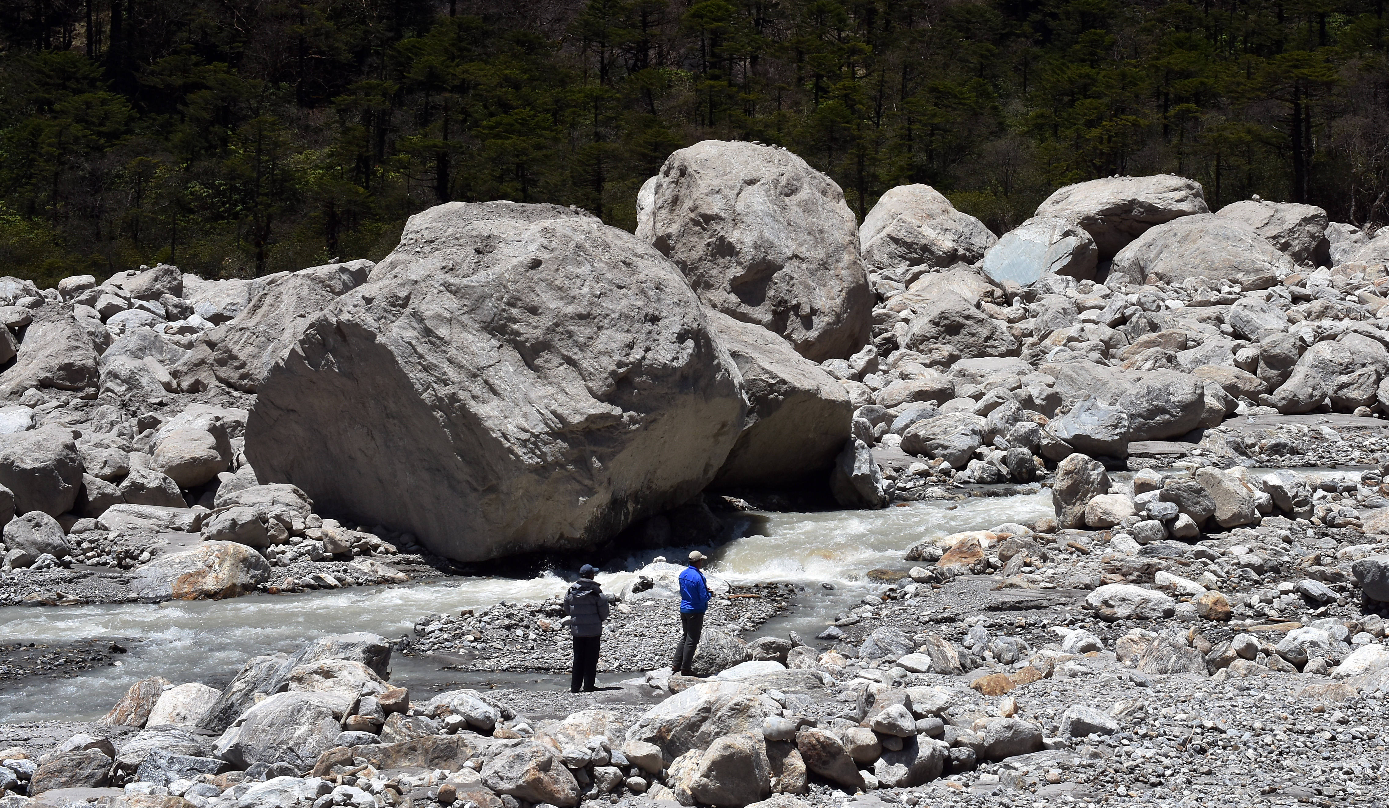
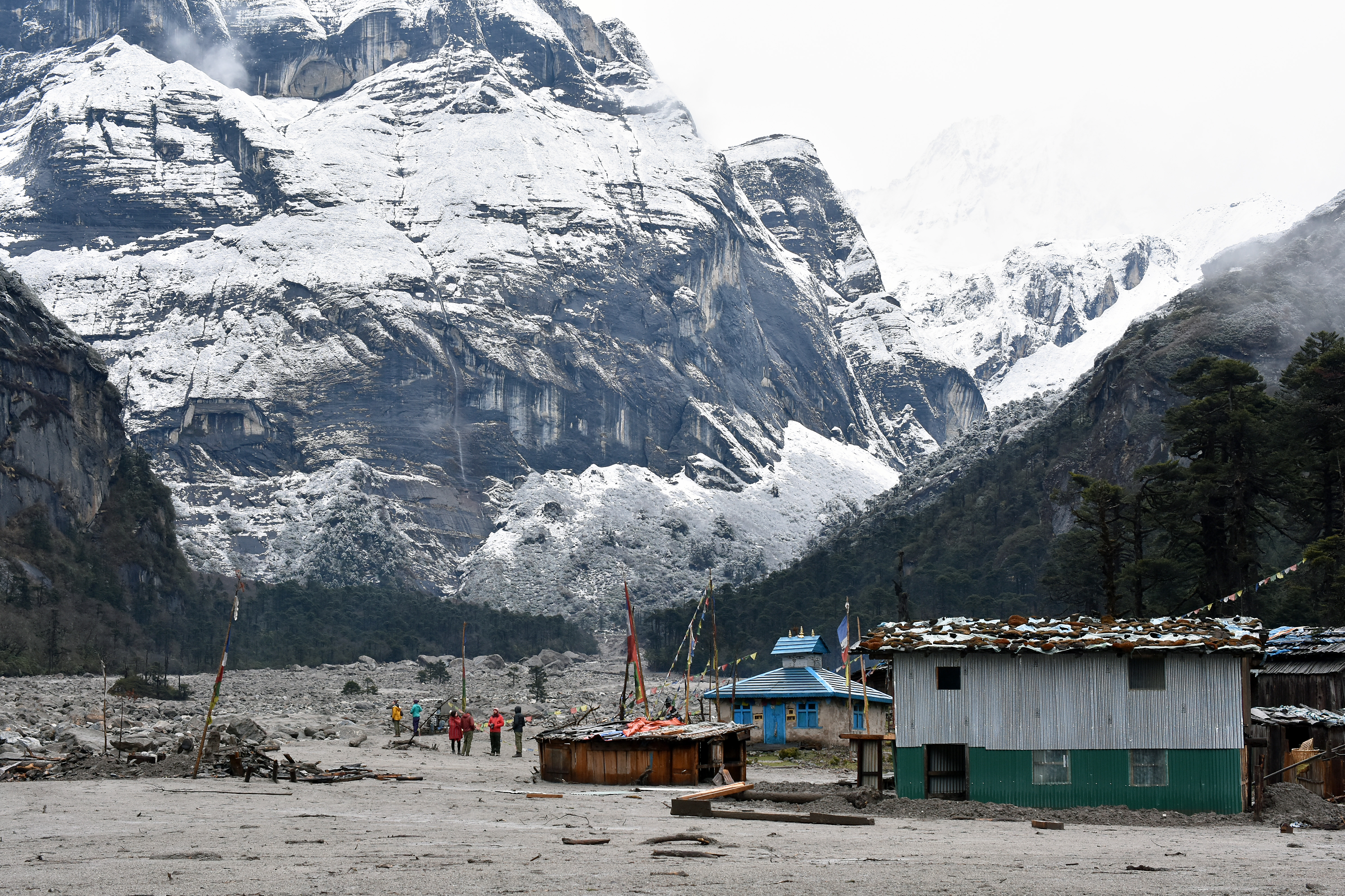
2. Yangle Karka, the largest pasture in the subalpine part of the Barun Valley, is now partially covered by rock and sand.
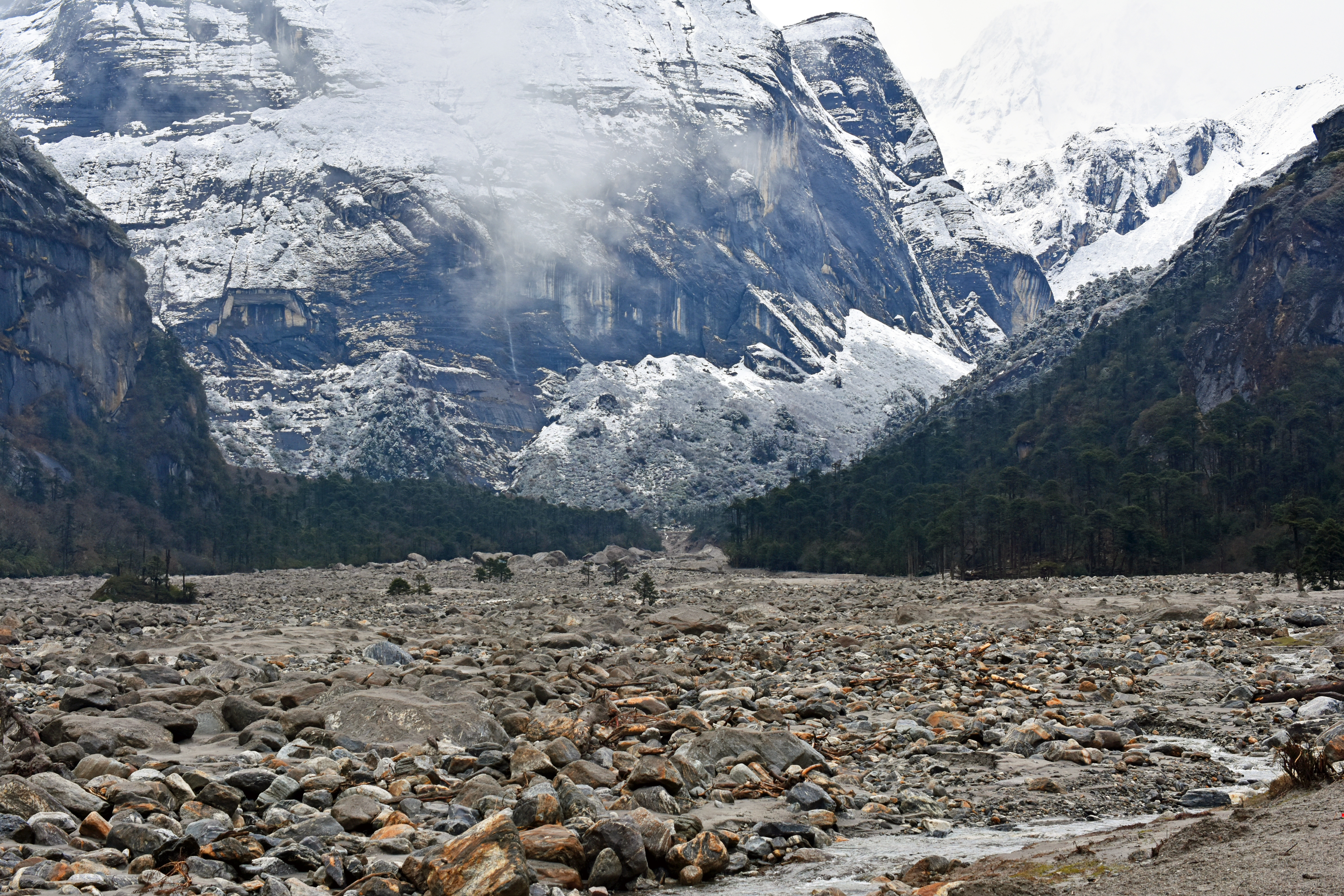
There are house-sized boulders in the upper part, near Nghe Kharka, with finer clasts further down valley. Apparently the flood, after descending a relatively steep section of the valley below Riphuk, slowed, lost some of its transport power and shed debris when it reached the flatter expanse of Yangle Kharka, a sediment filled lake basin (Byers et al., 2014).

The part of Yangle Kharka to the right of the Barun River, where we used to like to camp, has been completely covered by rock, sand and mud. The section just to the left of the river, including the original Buddhist gompa and a couple of newer wood and galvanized steel lodges has also been buried by a meter or so of debris. Lobes of fine sediment have invaded low-lying areas to the left of the river, but large areas of pasture, elevated a few meters, are unaffected. Some of the large, moss and tree-covered boulders, (glacial erratics?) that punctuated Yangle Kharka before the recent flood remain, standing salient amidst the fresh debris.

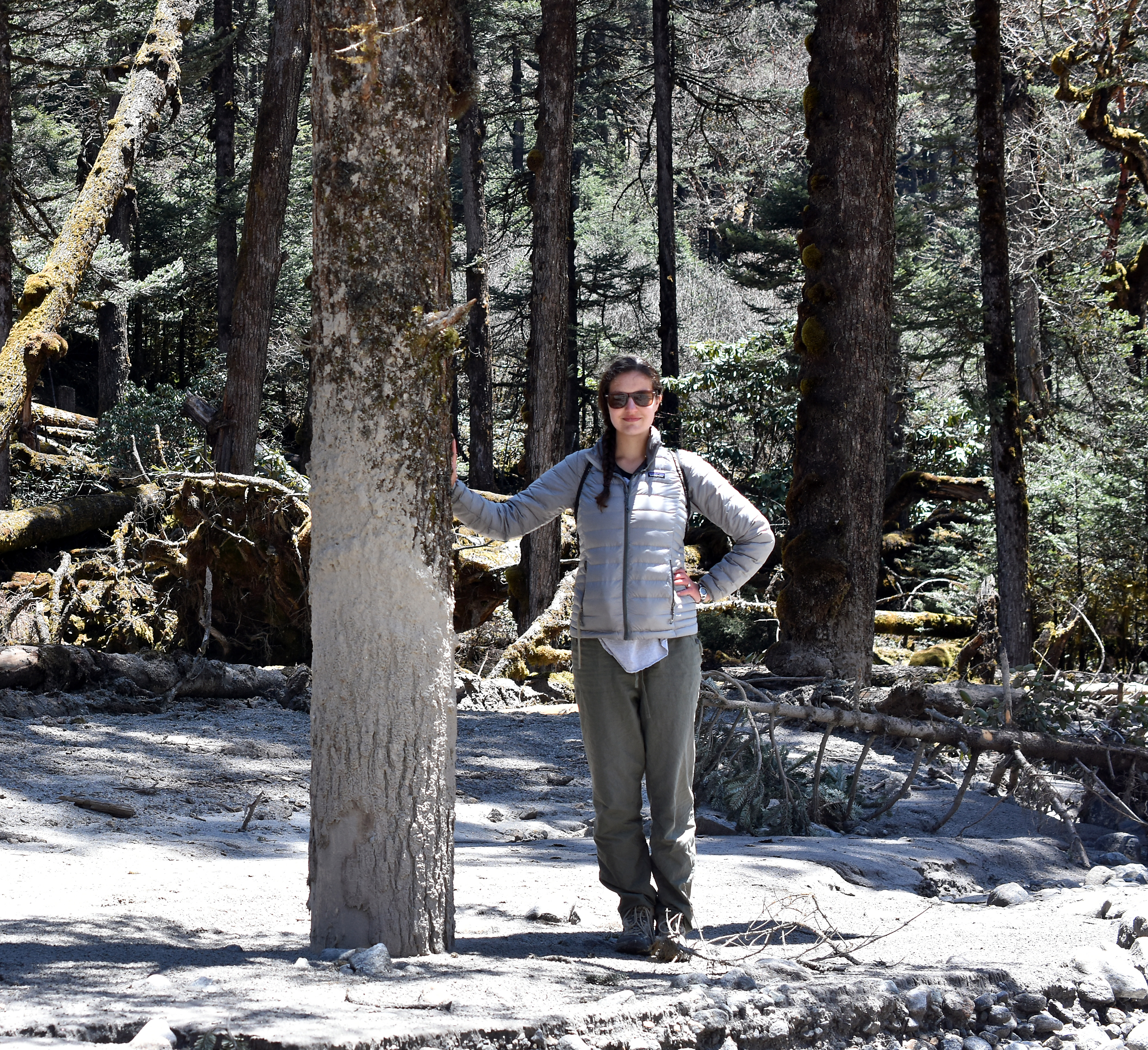
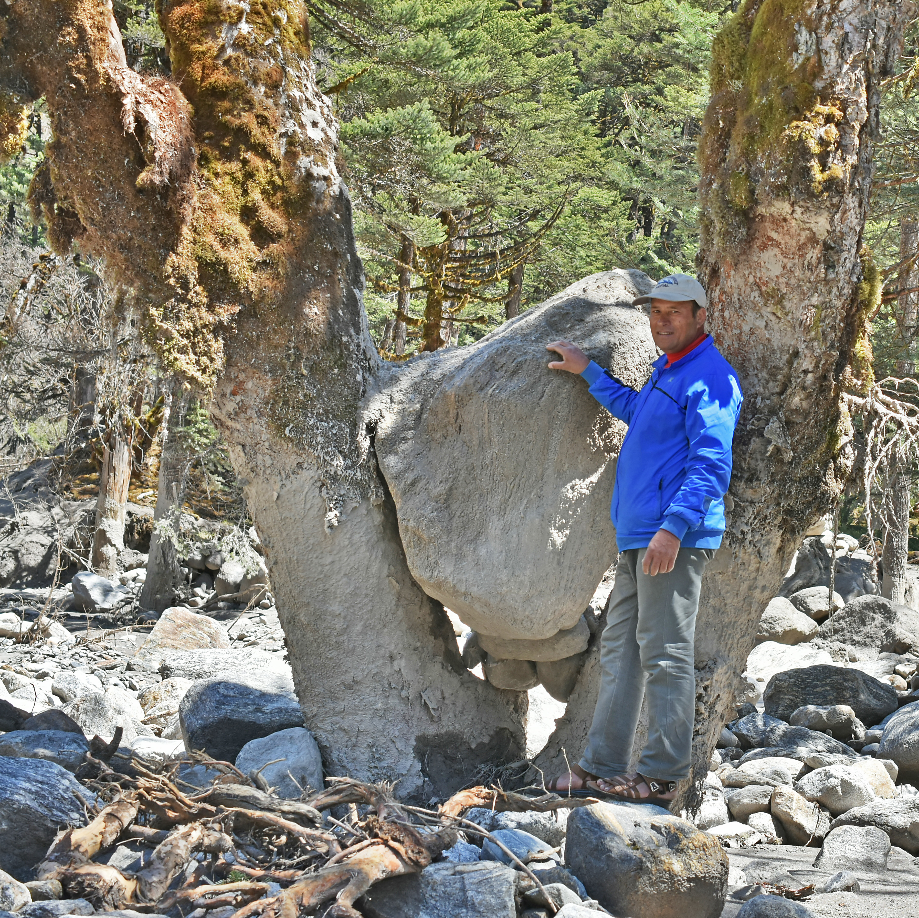
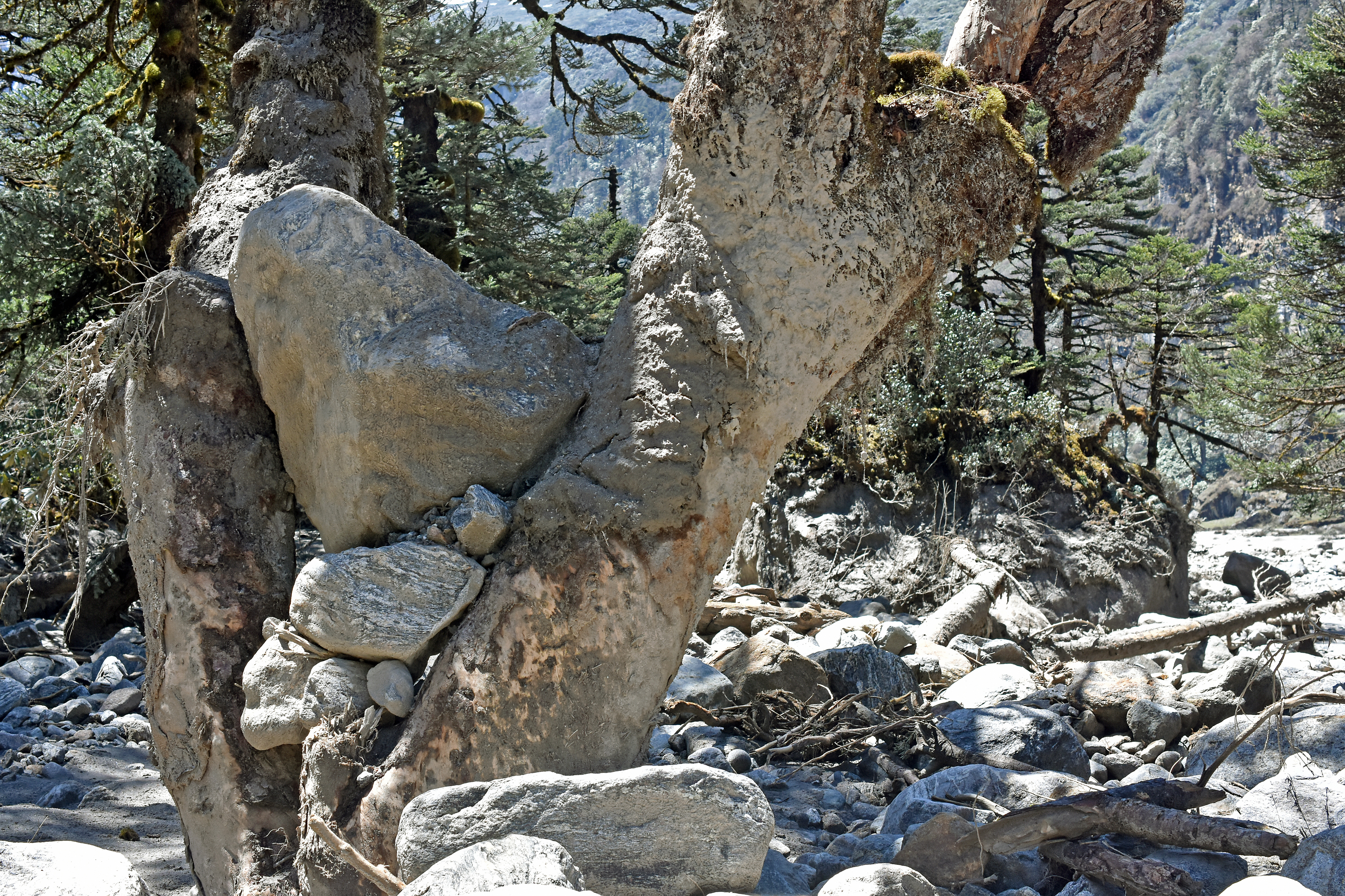
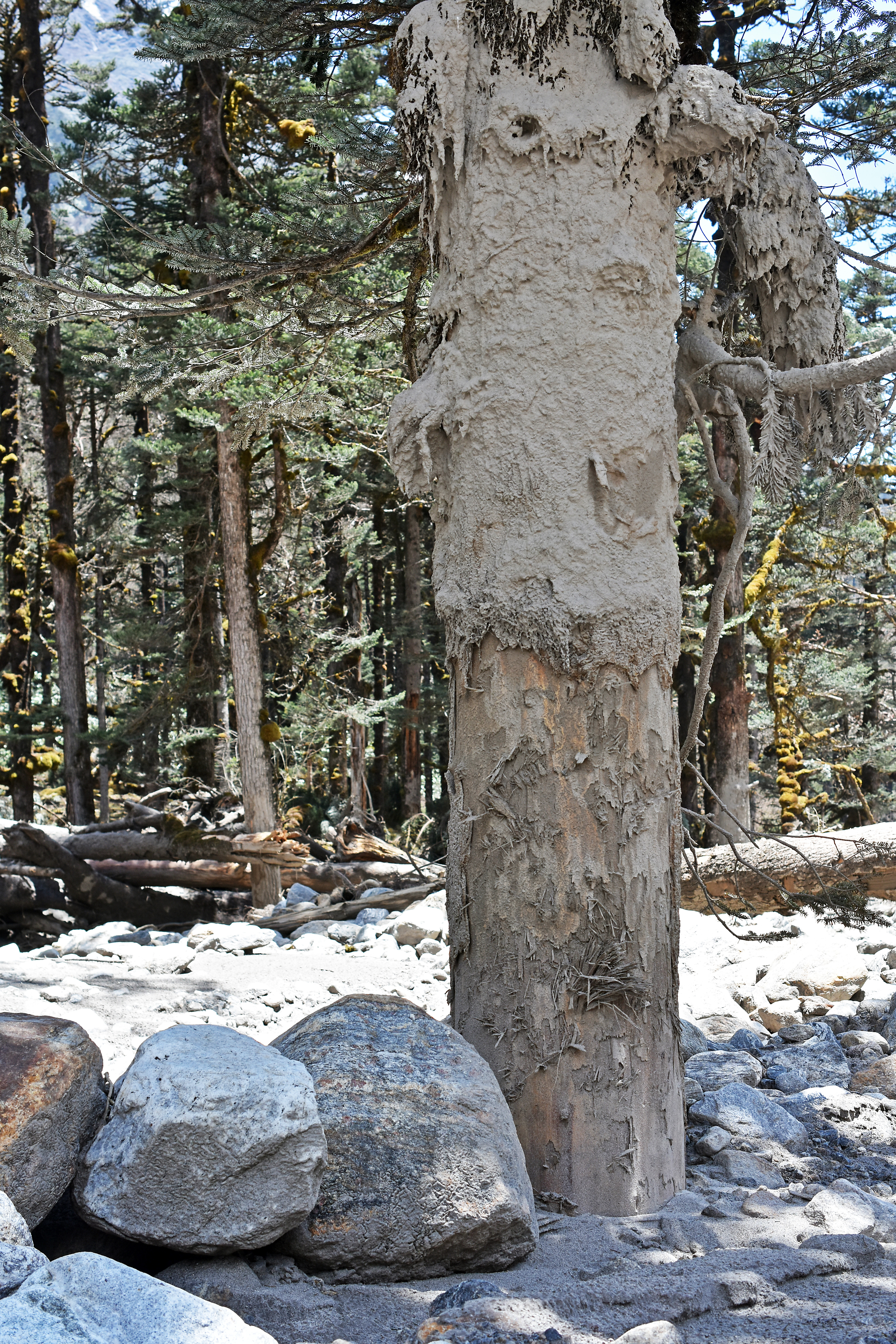
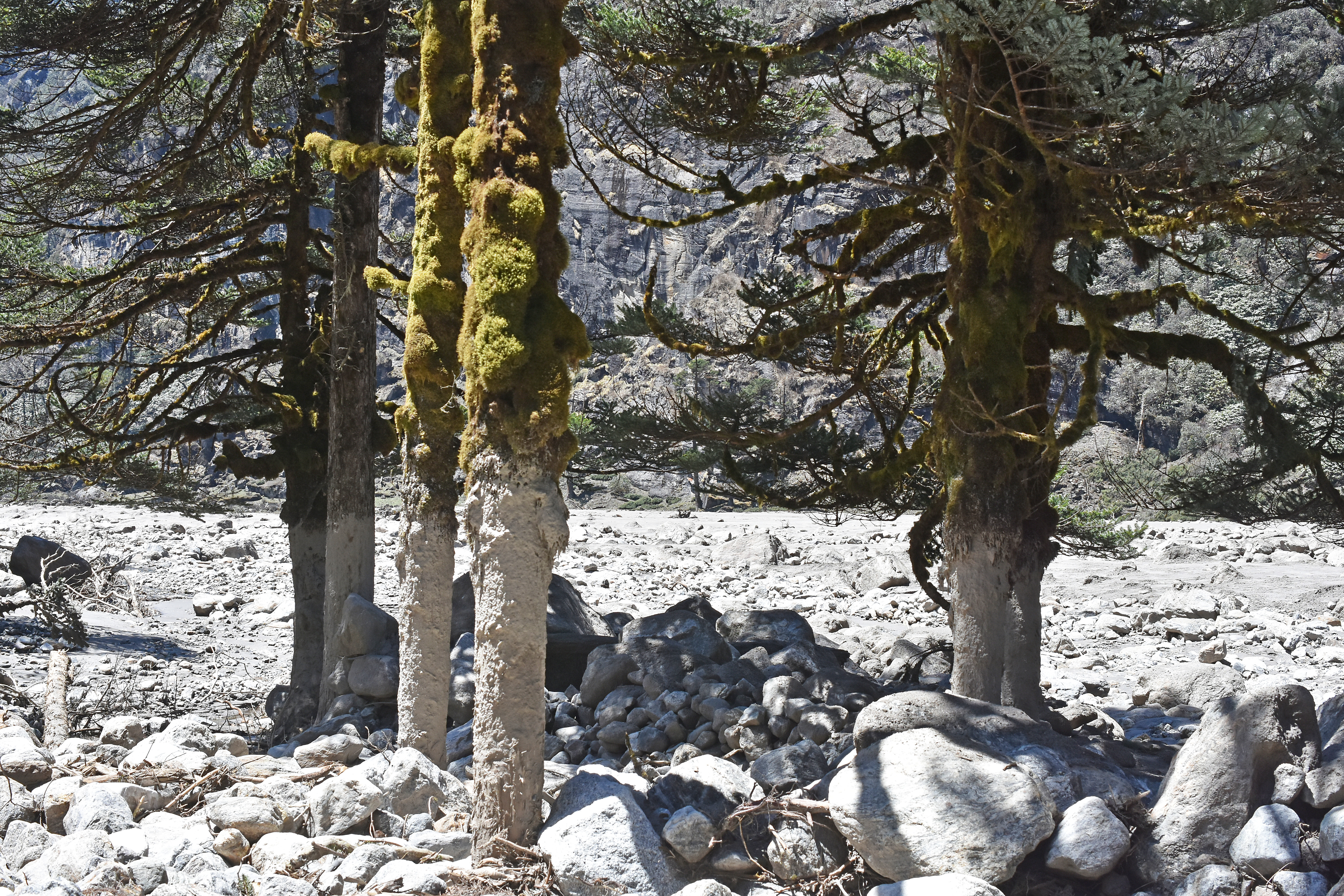
Forests along the two kilometer section of the valley that extends upward from Yangle Kharka to Nghe Kharka were thrashed severely by outburst flood debris. Byers et al. (2014) cite evidence from the shape and size distribution of the forest vegetation that similar damage may have occurred here on prior occasions during the past century, although perhaps not as severe as the event of April 20. Our group observed hardened mud coating the mossy trunks of fir trees to a height of 3-4 meters.
Birch trees with forking trunks have strained cubic meter sized boulders from the water column and hold them high above the ground.
Abrasion from finer sediments has stripped bark clean from the base of numerous trees that might otherwise survive the inundation.
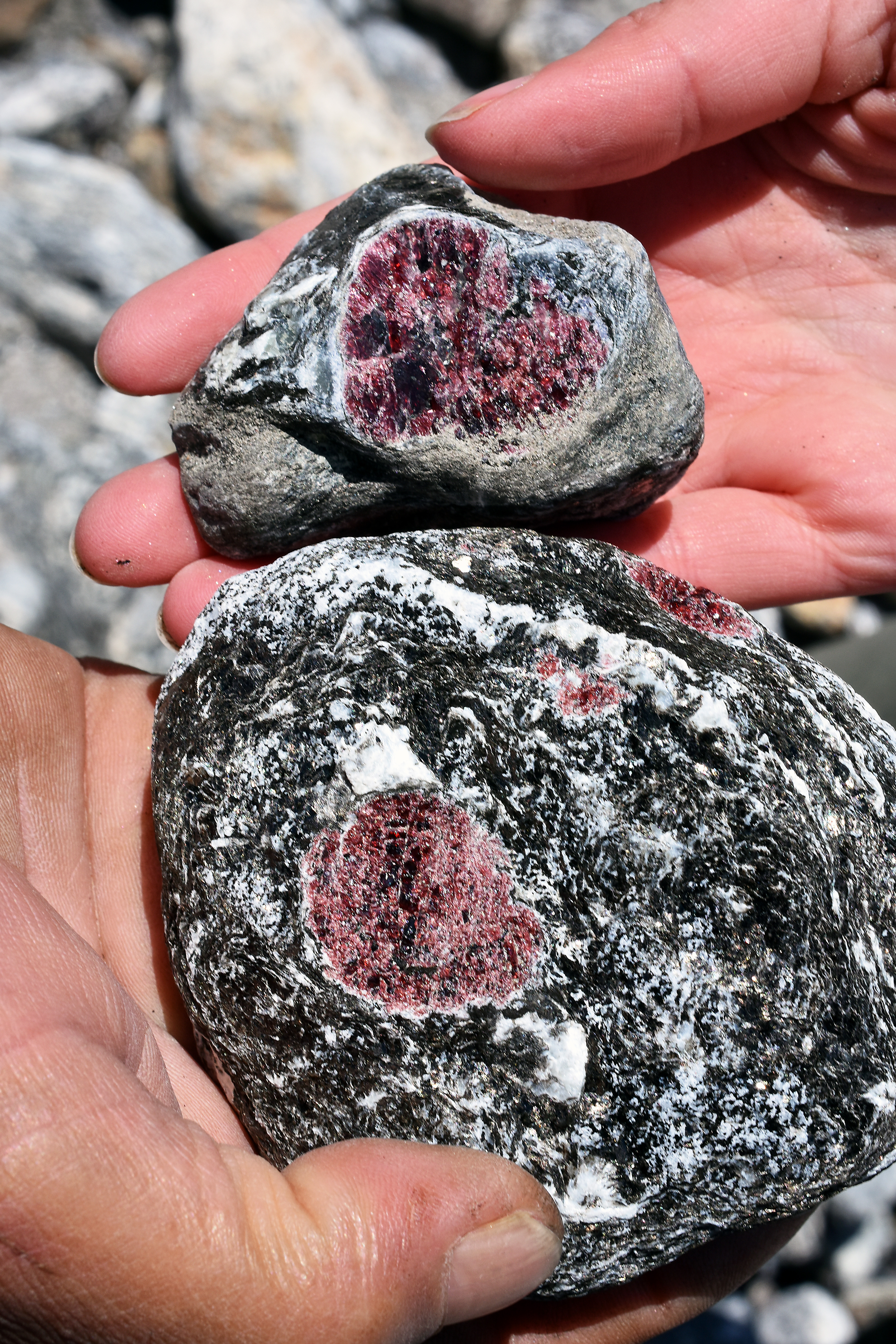
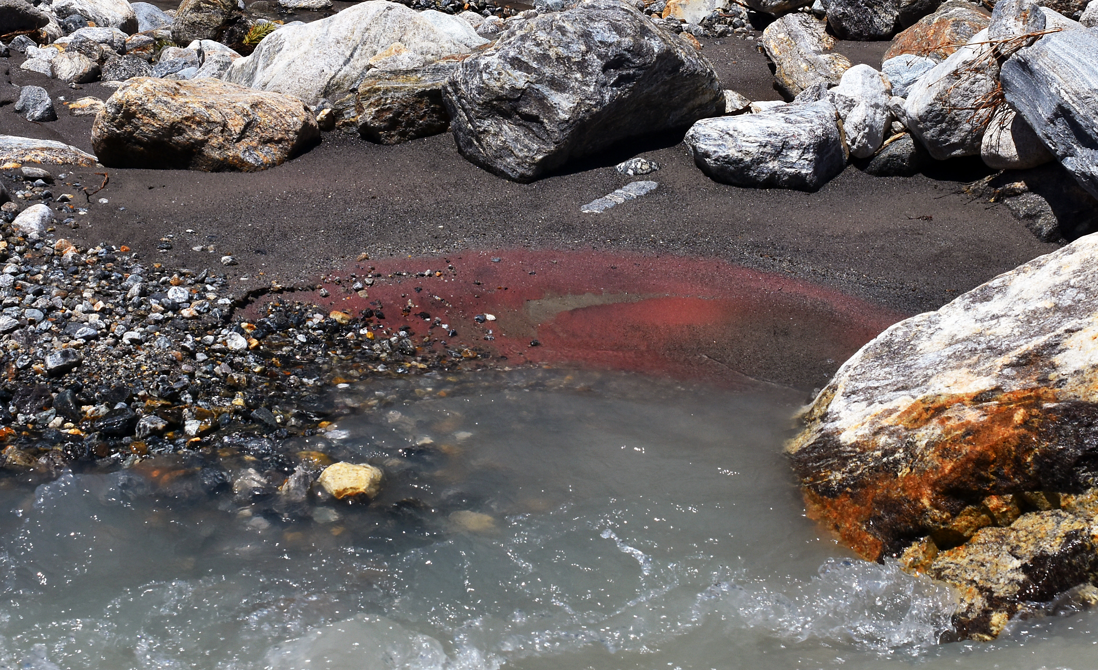
Among the rocky debris, many large, beautiful garnets were exposed in gneisses that had disintegrated on their turbulent journey down valley, and fresh mud along new river channels had already acquired a crimson patina of garnet dust.
People who were present at Yangle Kharka on April 20 first noticed a cloud of dust rising up valley and heard a fearfully loud roaring noise. The time was late morning, getting on towards noon. A few minutes after the first disturbance (we heard estimates of ten and thirty minutes), the flood reached Yangle Karka. This delay between the sound and the fury, and the flood’s midday occurrence, may be why there were no human fatalities. According to witnesses at Yangle Karka, the flood reached maximum flow in the first few minutes, surged hard for about one hour, then declined over the remainder of the afternoon to a normal rate. By late afternoon, the debris train had traveled the length of the Barun valley and debouched into the main stem of the Arun river, damming it temporarily. The dam gave way shortly thereafter, producing a non-catastrophic surge downstream.
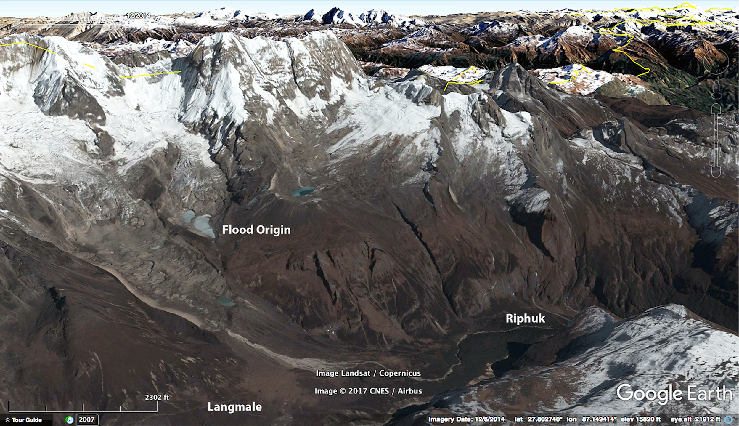
3. The Source of the Outburst Flood. On our way from Riphuk to Langmale, it was necessary to cross debris from the upper part of the outburst flood, which appeared rather formidable on the approach from below. The crossing above Riphuk required about 400-1500 meters of walking through fresh rock debris, depending on one’s inclination to find an alternative route by bushwhacking through willow and juniper. The most imposing part is a bluff, perhaps 30 m high on the right side of the channel that carried the flood. But the debris is well-cemented and competent, and a path of sorts has already been established. It is only necessary to look out for the occasional patch of quicksand in flat, depressed areas.
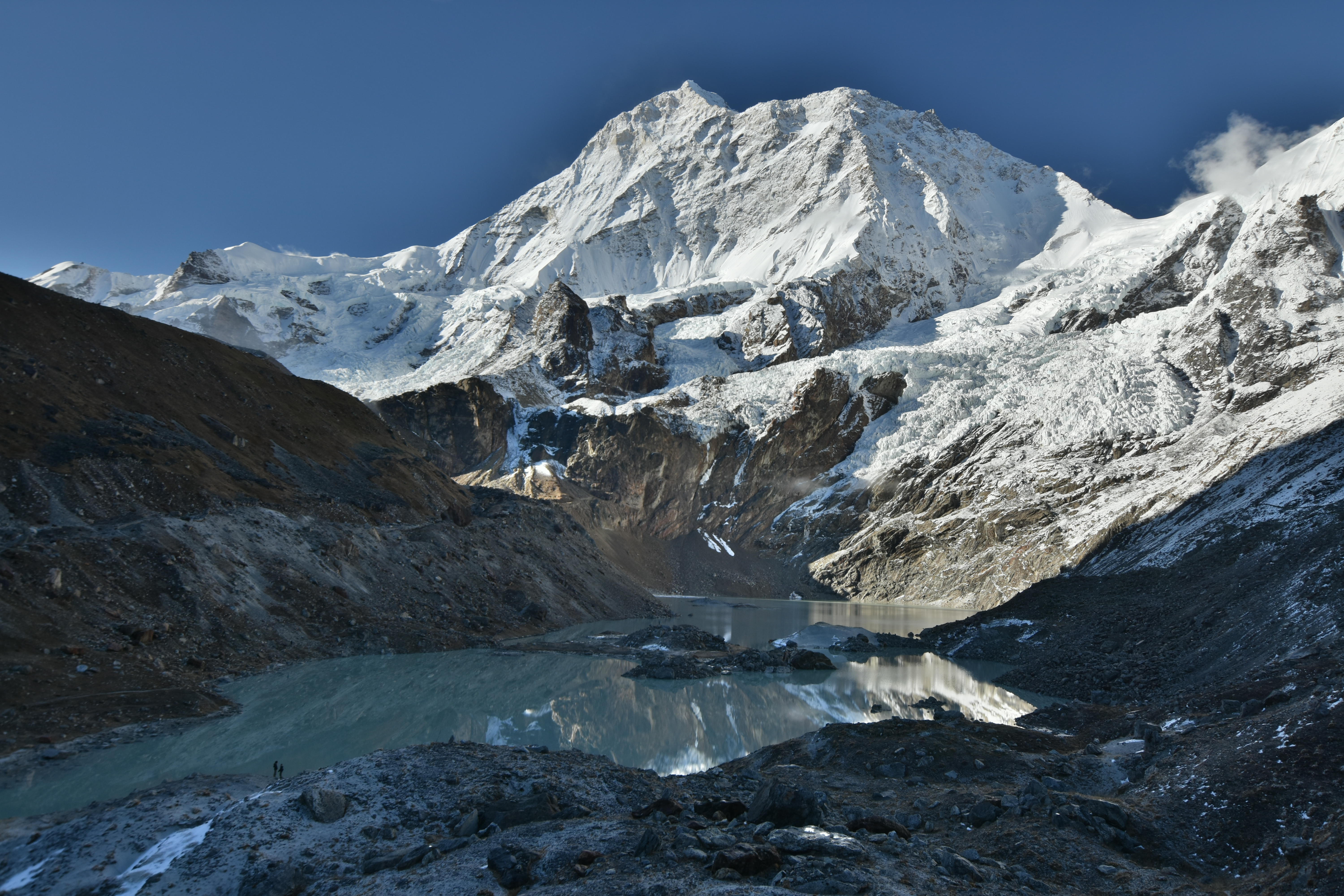
In its upper reaches, the outburst flood was most destructive. The source was a lake the local people call Seto Pokari (27.812° N, 87.138° E), one of several small water bodies (~0.1 km2) located at 4800 m elevation in a moraine-bounded basin a few hundred vertical meters above the left bank of the Barun River between Riphuk and Langmale. We were not aware of any witnesses to the event at either of those places, the caretakers of lodges at Riphuk and Langmale were all at Makalu Basecamp at the time, but it is understood by the seasonal residents of Barun Valley that the outburst flood happened when a large avalanche fell into the lake from above, displacing its contents and causing them to breach and break the terminal moraine that had impounded them.
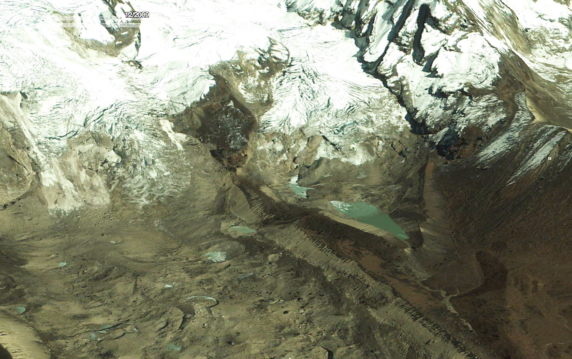
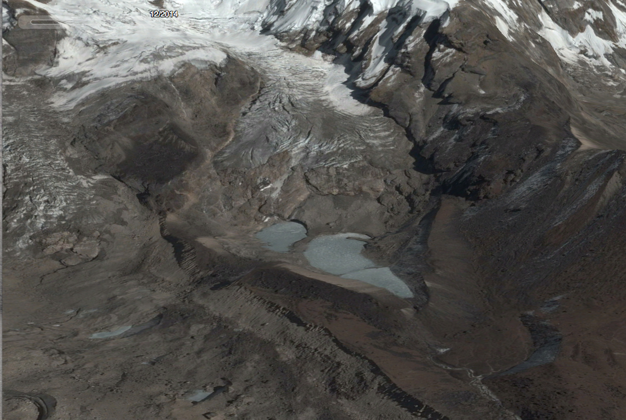
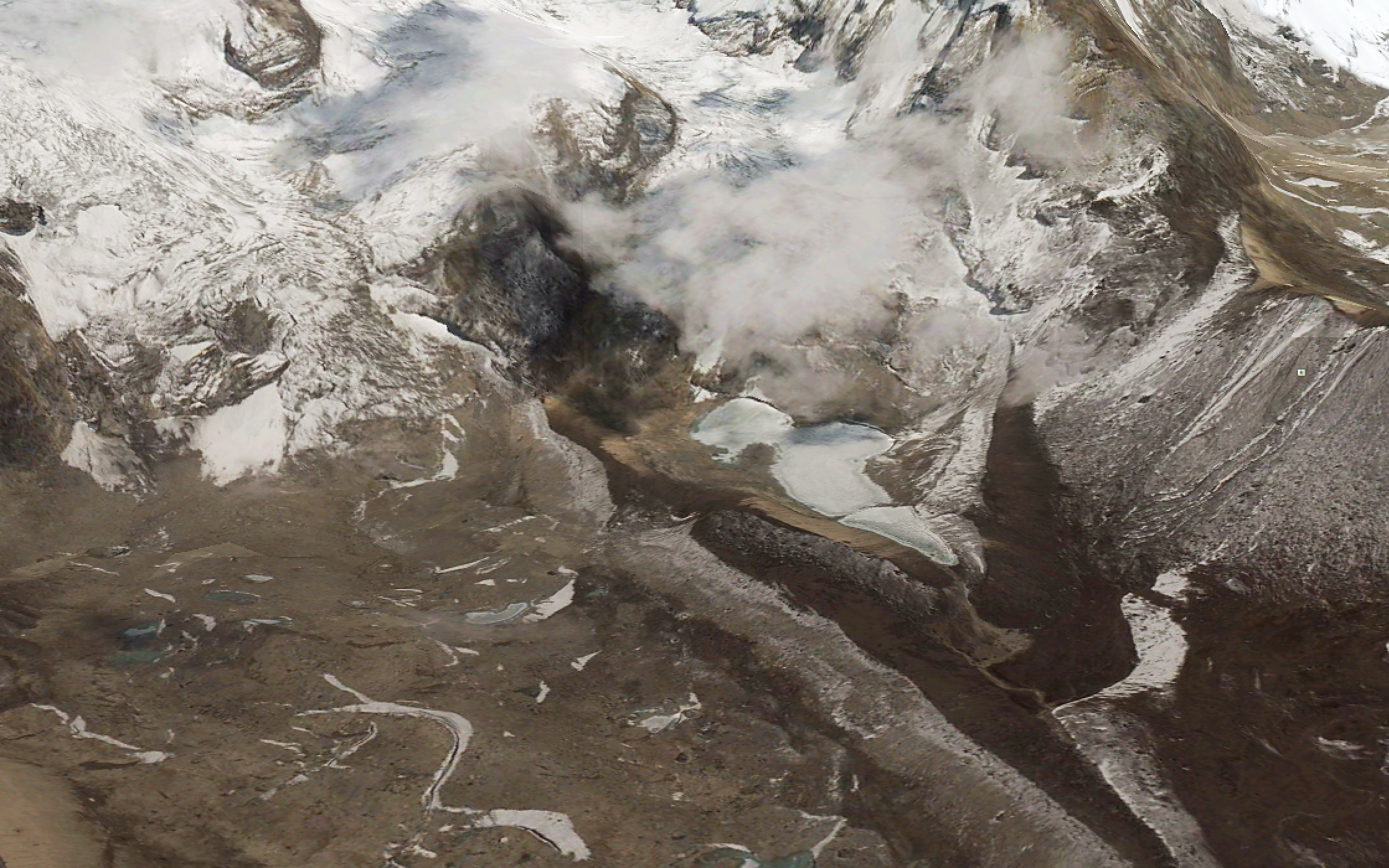
‘Seto Pokari’ — White Lake — is about the most generic name imaginable for a periglacial water feature in the Nepal Himalaya, so we didn’t realize until we arrived in the upper Barun that the GLOF we’d been seeing had issued from this obscure side basin and not the vastly larger water body impounded above the terminus of the West Barun Glacier. We’d already surmised that it hadn’t come from the other Seto Pokari, a beautiful lake that reflects Makalu a few hundred meters above basecamp
We spent one morning hiking from Langmale up the moraine in the direction of the GLOF’s origin, and I got the impression from previous erosion scars above dry lacustrine sediments that this basin is a likely source for the relatively frequent, middle-sized outburst floods that Alton Byers and his colleagues found evidence for in 2014. On our day in Langmale, threatening weather and a vague sense of menace kept us from venturing too far up into the basin.
Eyewitness accounts from Yangle Kharka concur on one point, the outburst was accompanied by a great deal of dust. We noted several millimeters of dust fall on the ground and coated on the leaves of alpine rhododendron in the vicinity of Langmale, about a kilometer up valley from the outburst site. Dust fall declined gradually in the direction of Makalu Basecamp and we saw no dust on vegetation in the direction of Riphuk, down valley. This pattern conforms to the daily springtime cycle of strong upvalley winds commencing in the mid-late morning, but isn’t easy to reconcile with evidence of strong flood-generated winds in the downstream direction.
A couple of kilometers below the outburst lake, the Barun river descends between the pilgrimage site of Amabhuchung (the rock that evokes a pregnant woman) and Riphuk (a site associated with Guru Rimpoche, founding sage of Tibetan Buddhism).

It is here that the Barun river veers right and descends more steeply, and it is here that the flood was particularly destructive. Local people explained how a rock outcrop on the steeply descending section above Yangle Kharka steered flood waters into the late-successional fir forest that grows in this area, destroying many trees. Eyewitness accounts (which we heard second-hand) referred to the leading edge of the outburst flood as a “30 foot wall of tree trunks” and locals mention a great tearing roar, lots of dust and strong wind as the surge passed through. We noted, where the path passes through the Riphuk fir forest, that there was a great deal of recent wind throw, and that numerous mature (senescent?) fir trees had been snapped and toppled in a direction facing away from the flood, that is, they had broken as though the wind had been blowing down valley, opposite the expectation for a pre-monsoon squall. Local people later told us that yes, indeed, trees in the forest below Riphuk had been toppled by strong winds driven by the outburst flood. One family lost 35 head of yak and chauri (yak-cattle hybrids) in the pastures below Riphuk. At least one carcass had been salvaged, its meat dried to strips of sukuti and sold to protein-craving visitors like ourselves.
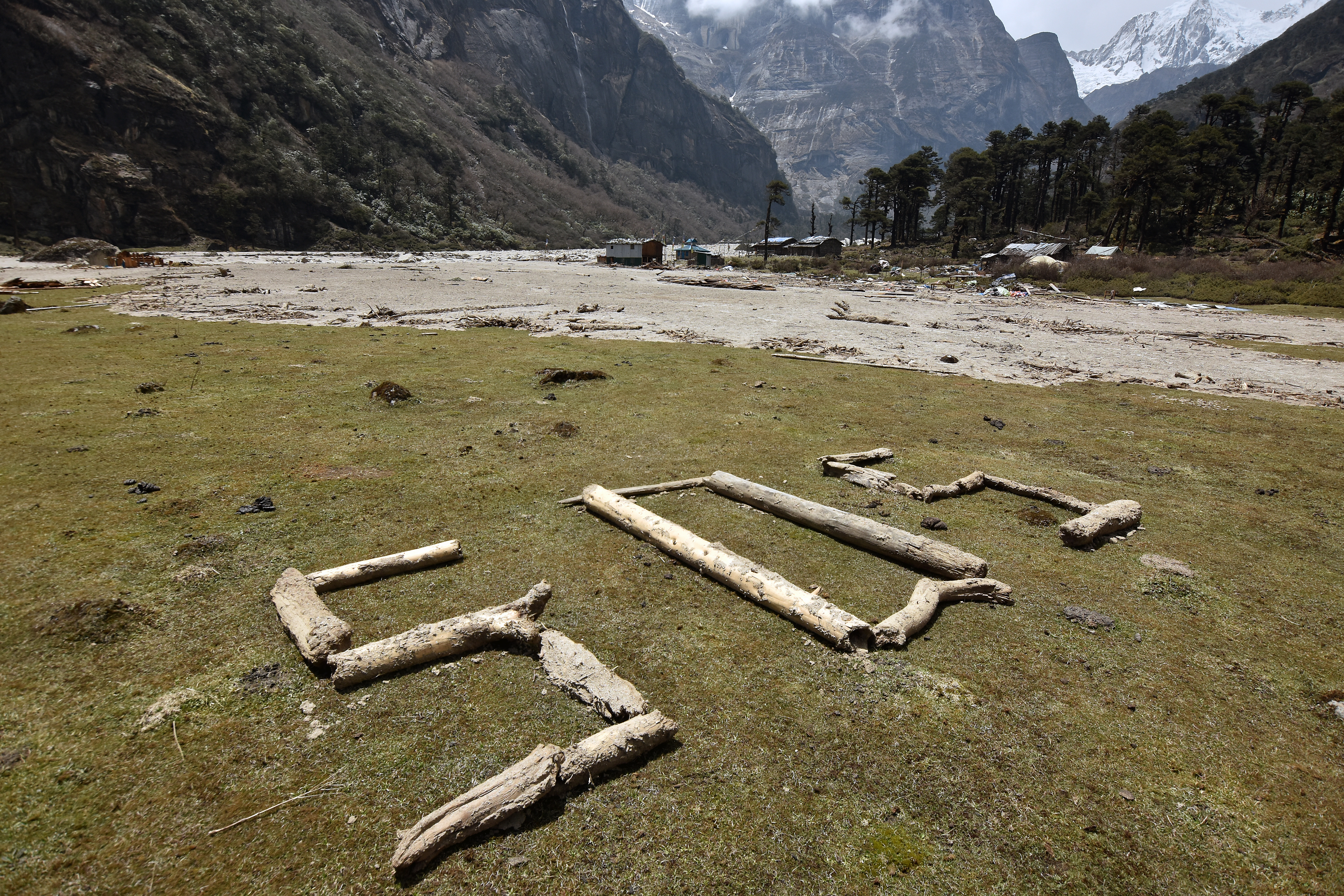
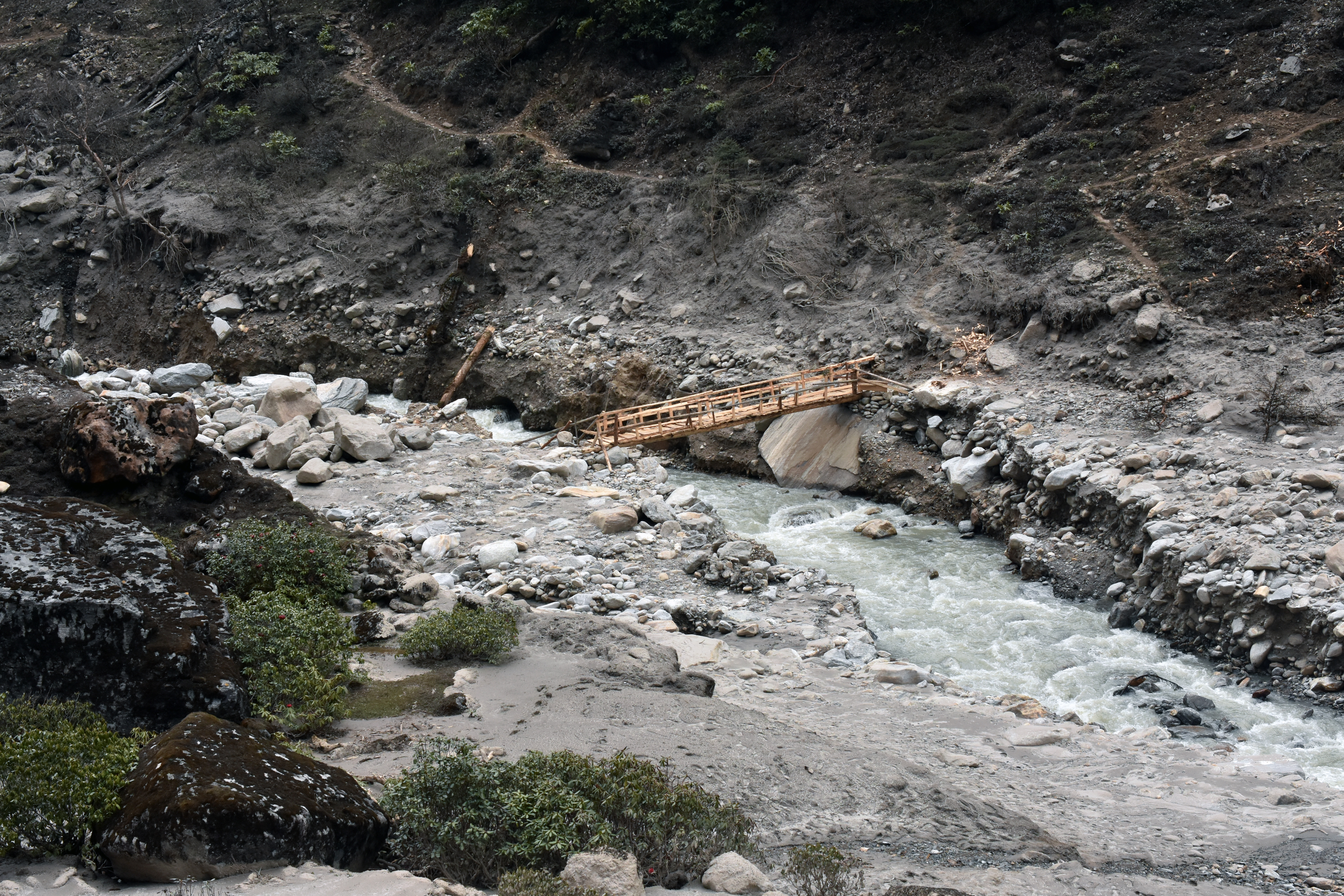
Seasonal residents of the Barun Valley, mostly Sherpa people from the villages of Navagaon and Tashigaon in the Kasuwa valley to the southeast, suffered obvious economic hardship and much inconvenience from the glacial lake outburst flood, which coincided with the onset of the mountaineering season on Makalu. The response we saw was proactive and self-reliant, as befits people who have spent generations in a particularly remote, steep, wet corner of the Nepal Himalaya. As a case in point, the main path that followed the right bank of the Barun from Tematang to Yangle Karka had been obliterated, so a secondary path on the other side of the river was put into use. The family that maintains the lodge at Tematang wasted no time building a temporary bridge within a few days of the flood, to facilitate evacuation from the area. By the time we arrived in May 6, they had upgraded this to a proper plank bridge made from salvaged fir. They accepted donations for its construction, but weren’t soliciting them.
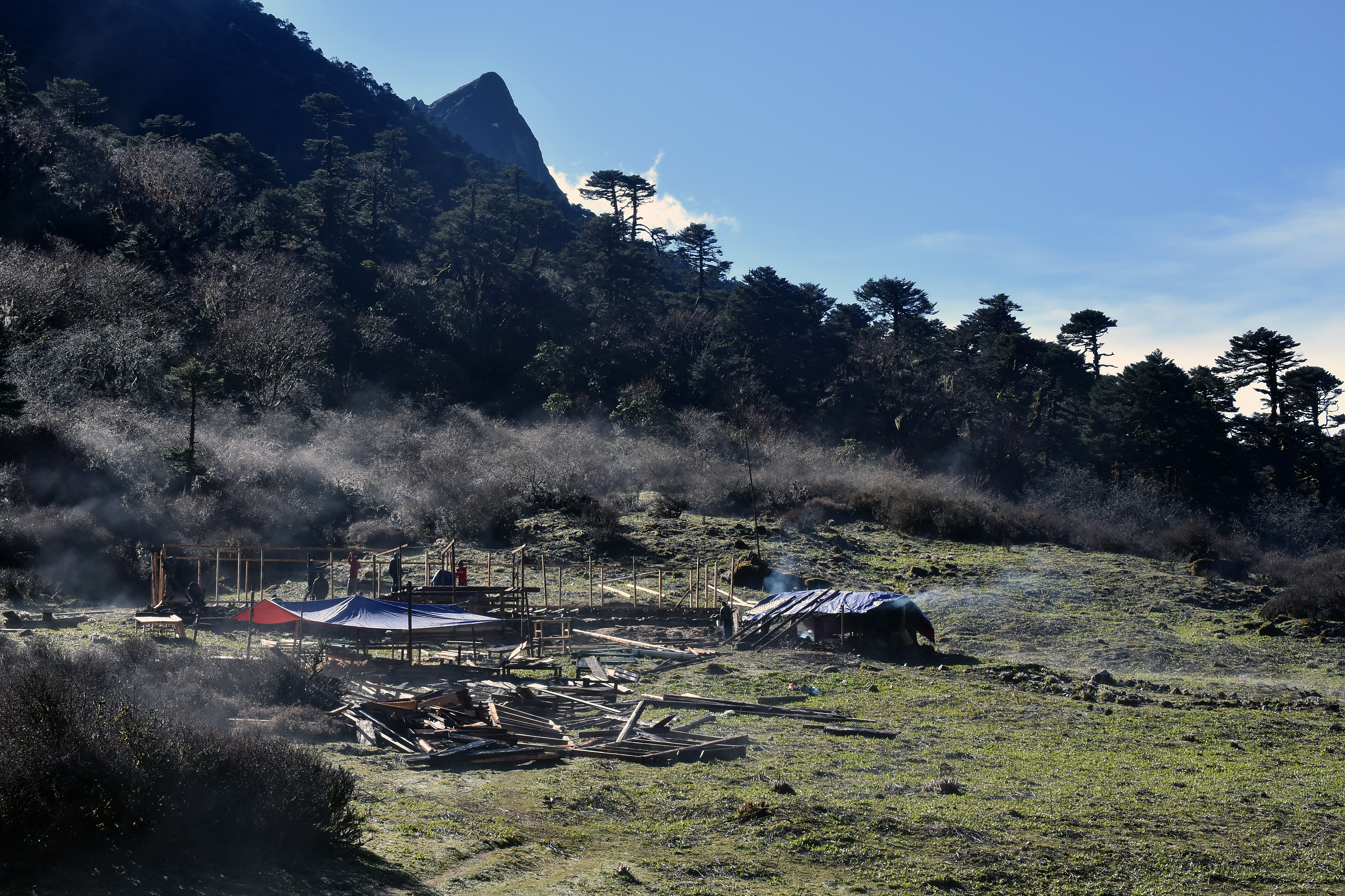
When we first reached Yangle Karka on May 6, the old gompa, destroyed by the flood, and been uncovered and some of the sacred objects had been removed for safekeeping. Wood framing and sheet metal from two destroyed guesthouses had been moved to the upper part of the pasture on the left side of the river. By the time we passed Yangle Karka the second time, on our way down on May 13, construction was well underway on two new lodges perched at the upper reaches of the pasture. They will be situated well away from the river and will benefit from a better view of the sacred Shivadhara massif so spectacular across the valley, and perhaps warmer temperatures and less wind, due to their sheltered, upslope location.
Acknowledgements:
Sincere thanks to our students, patient with my foibles, and to our guides, exemplary even by the high standards of Nepal, who helped to make me feel safe and capable on this program, despite myself. Om Bahadur Basnet, Bhakta Gurung, Kumar Basnet, Deepak Lama and Dol Bahadur Gurung, you are all among my heroes. And I wish to acknowledge the critical role of the Wildlands Studies program to make experiences such as these possible.
References:
Byers, Alton C., Elizabeth A. Byers, Dambar Thapa. 2014. Conservation and Restoration of Alpine Ecosystems in the Upper Barun Valley, Makalu-Barun National Park, Nepal. Final Report: National Geographic Society Conservation Trust Grant C259-13. The Mountain Institute Technical Report No. 2014.11.
Reinhard, Johan. 1978. Khembalung: The Hidden Valley. Kailash – A Journal of Himalayan Studies Kathmandu 6(1): 5-35.