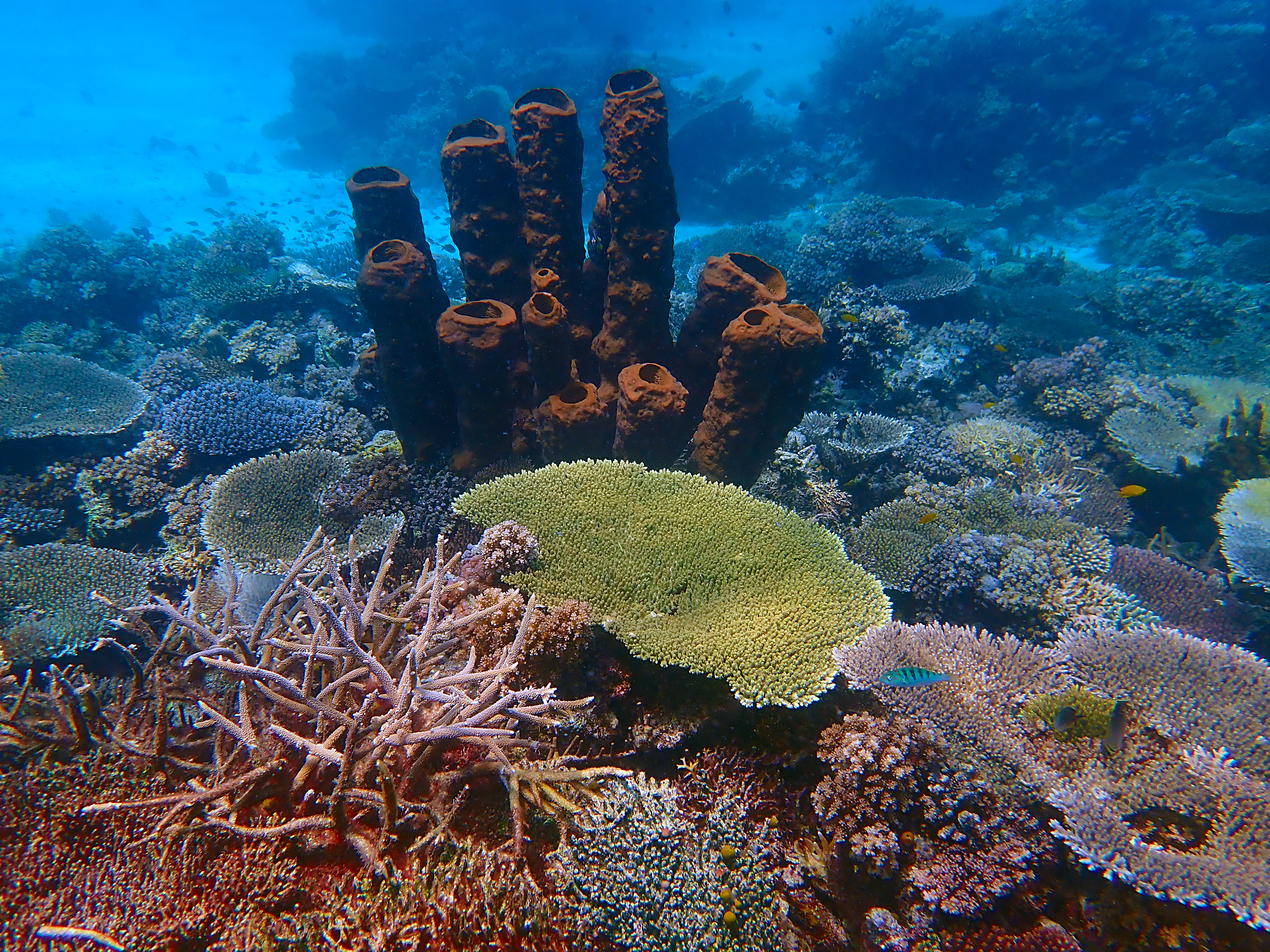
It appears that in the past ten thousand years or so, since the end of the Ice Age, sea levels have risen to inundate the coastline of the Togean Islands, but surrounding water of Tomini Bay are so calm that the inundated landforms remain largely intact.
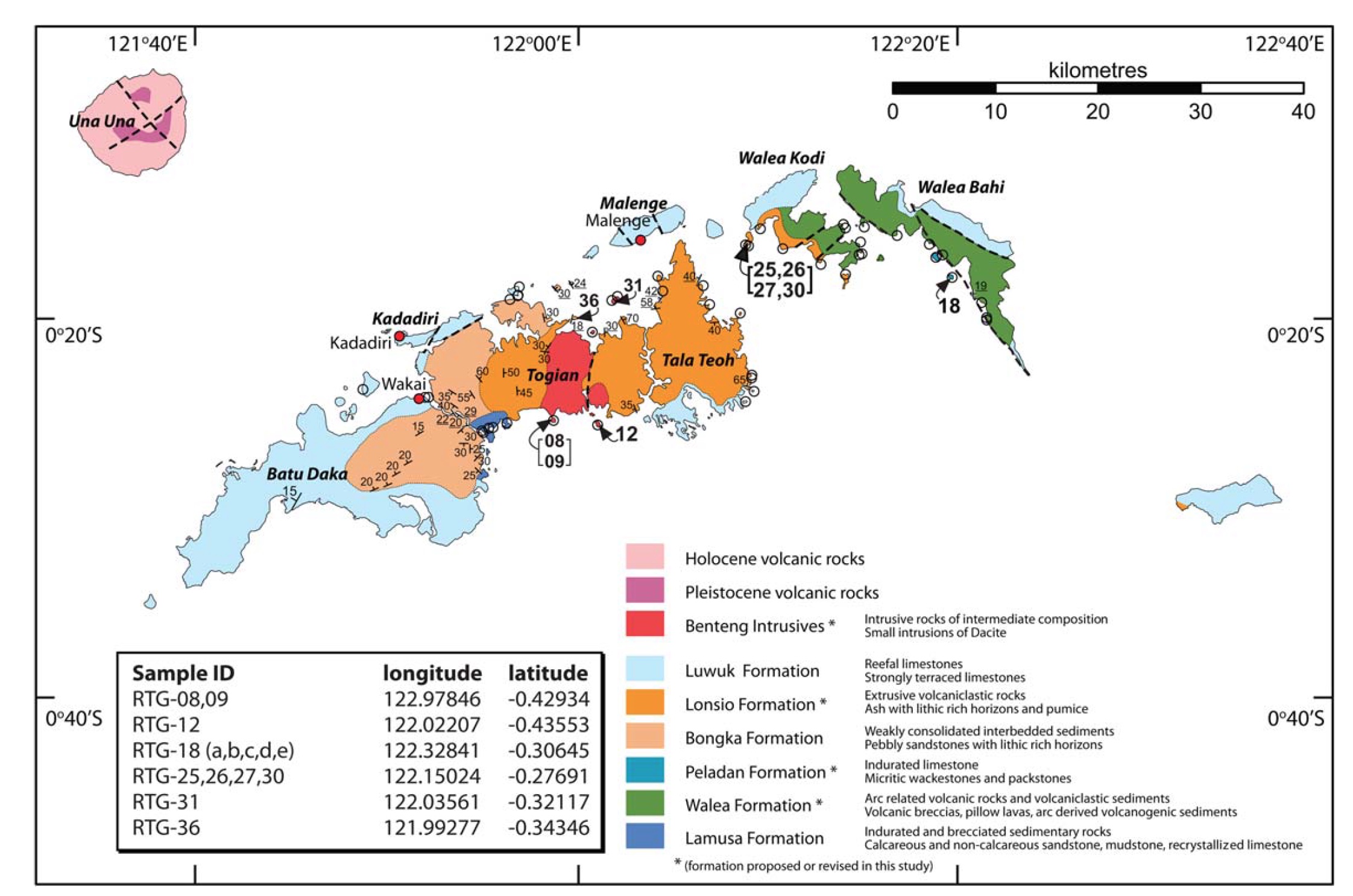
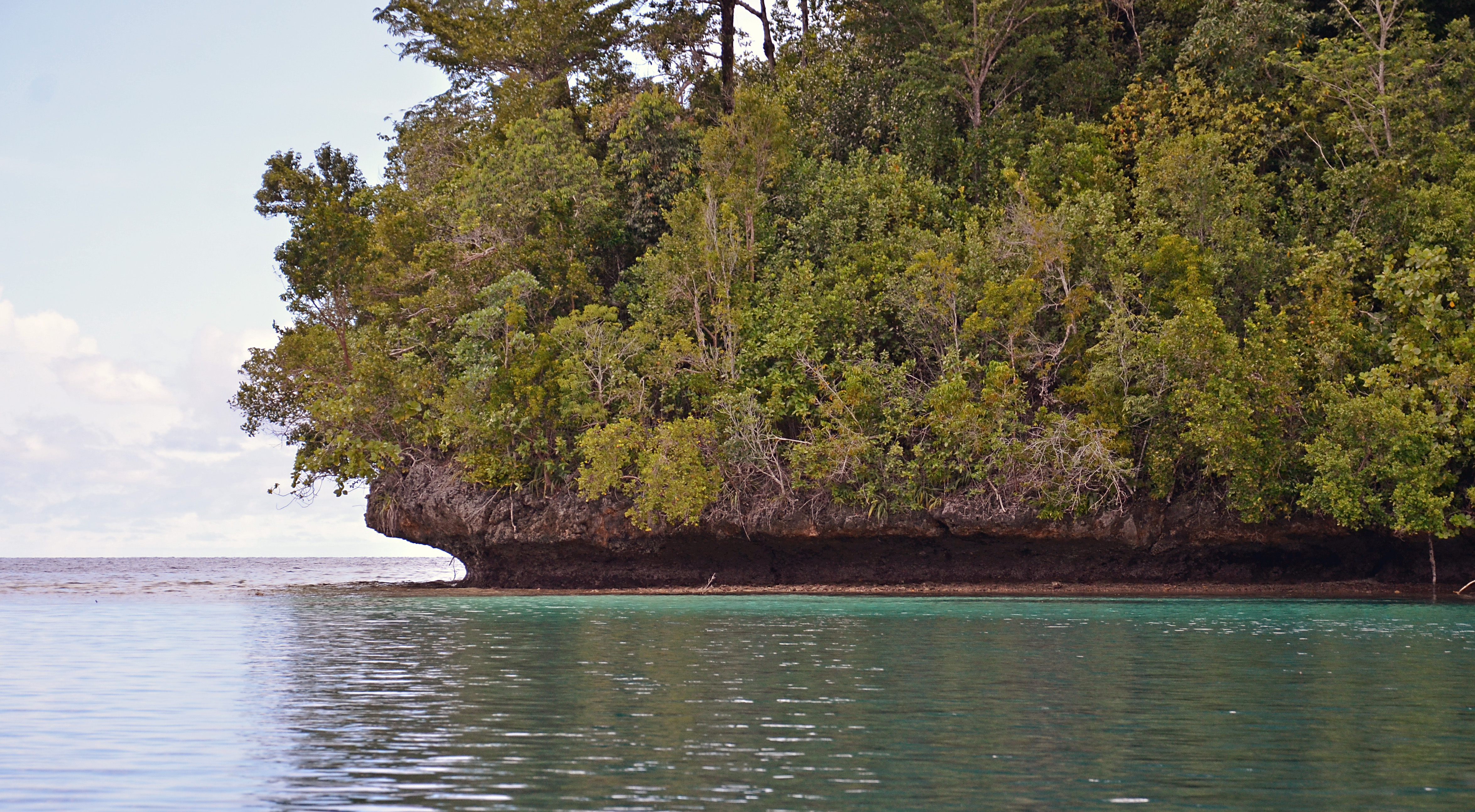
Much of the Togean Island shoreline is limestone, cropping up jaggedly about ten meters or so, sharply in-cut just above the high tide line. Like the limestone towers of southern Thailand, this calcium carbonate is biogenic: its crystal structure shows that it was precipitated from sea water by living organisms. However the creatures whose metabolic energy made the limestone of southern Thailand lived in Paleozoic time, more than 300 million years ago. The limestone of the Togean Islands is Quaternary, less than one per-cent as old.
A story of young limestone, formed from coral and raised a few meters above sea level, is compatible with the active tectonics of Sulawesi and Tomini Bay. This pattern occurs as well in other parts of Indonesia like Flores island, where limestone from Quaternary coral reefs has also hoisted above sea level. But the Togean Island shoreline, which rose above sea level in the past couple of million years, appears to have partially sunken again in the past few thousand.
Does this argue for a more recent, tectonically-driven subsidence? It’s possible that the land has subsided, but Holocene (post Ice Age) sea level rise is a more parsimonious explanation. During the Last Glacial Maximum (less than twenty thousand years ago), sea level was more than a hundred meters lower than it is now. A rise to modern levels would be just about right to explain the flooded drainages, the artificial-reservoir-like bays, and flooded dolines like Jellyfish Lake.
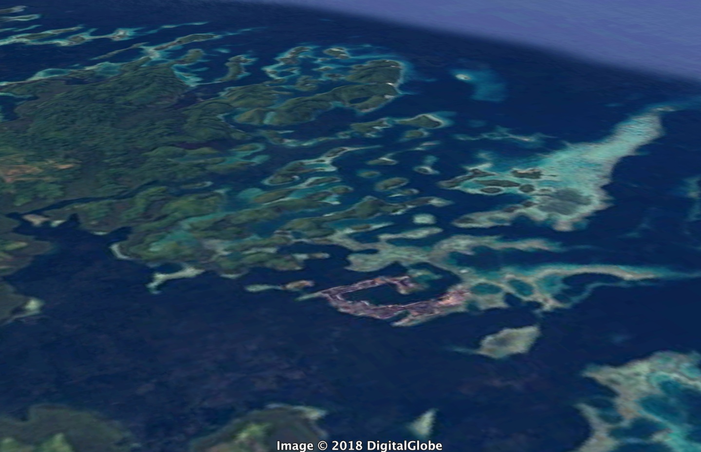
Five atoll-like platforms rise from deeper water a few kilometers off the northern edge of Malenge Island. The westernmost platform, called California Reef, is nearly exposed at low tide, the easternmost, Reef Five, is several meters below the surface. These are not true atolls, which are oceanic structures, but are probably low-lying surfaces that have submerged, eroded smooth and acquired a veneer of coral reef in Holocene times. The sides of California reef, too steep to support coral, may be composed of the Quaternary limestone, though it would be good to check that more carefully.
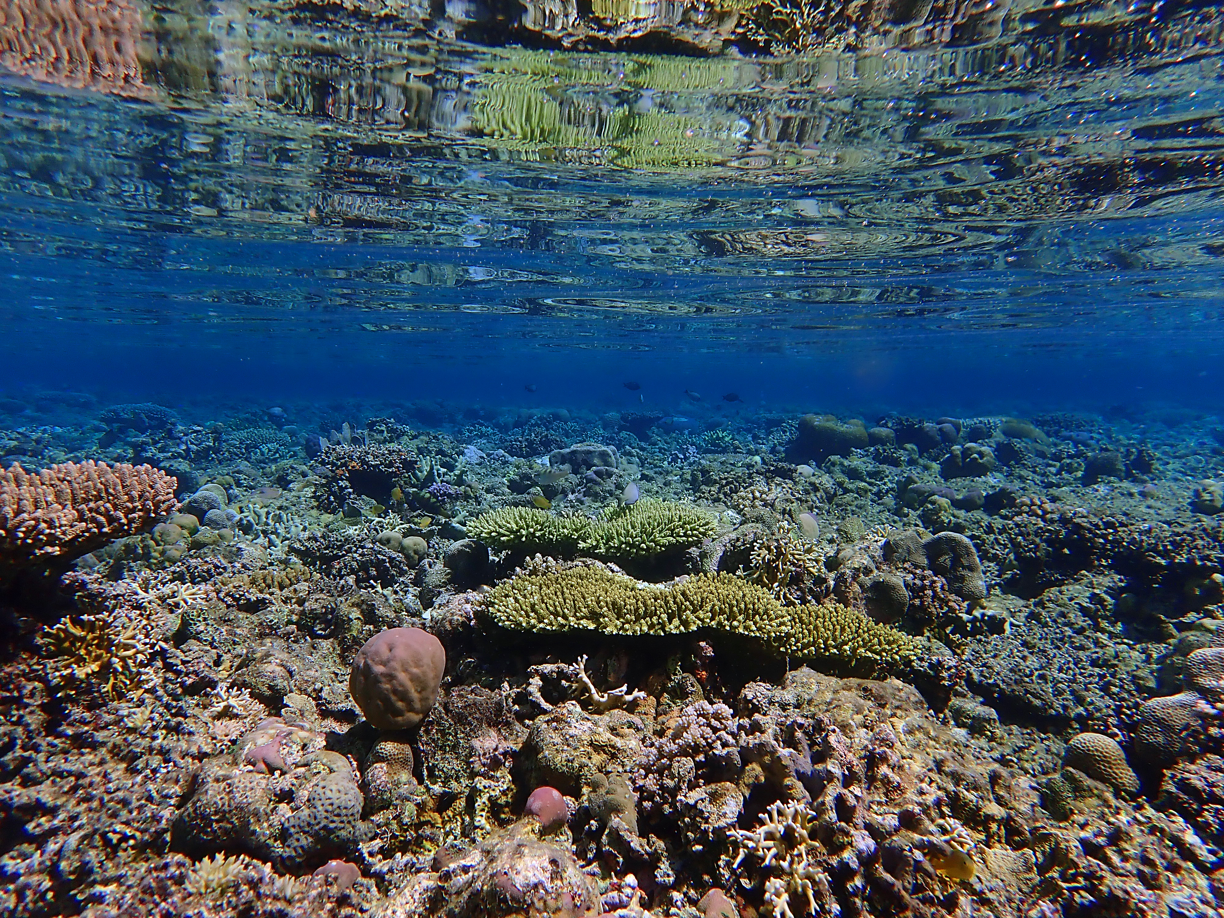
As sea levels have risen over the past 12,000 years or so, pre-Holocene landforms have been inundated without having been destroyed by wave action. Tomini Bay, which surrounds the Togean Islands, is especially placid by oceanic standards for a couple of reasons. First, it lies almost exactly on the Equator, so it does not receive typhoons, which are bound to drift poleward as they strengthen. Second, Tomini Bay is sheltered by the northern and eastern peninsular arms of Sulawesi, offering a safe harbor not only from the waves of more distant storms, but from those of the seasonal trade winds that blow down from the East China Sea. Perhaps the sheltering arms of Sulawesi are explain how fragile topographic features like dolines and stream channels have survived intact along the shore of the Togean Islands, while they have been obliterated in other places like Peninsular Thailand. It more exposed locations, Holocene sea level rise would have been accompanied by higher wave energy that would have altered coastal features as they were inundated.